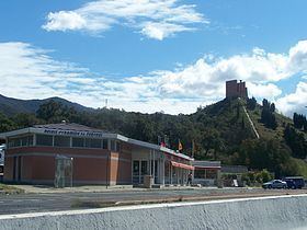
Location Le Perthus Range Pyrenees | Elevation 290 m | |
 | ||
Traversed by Route nationale 9, A9 autoroute, Carretera Nacional N-II, Autopista AP-7 | ||
Col du perthus tour de france 2016
The Col du Perthus is a mountain pass of the Pyrenees on the France–Spain border, between the Pyrénées-Orientales in Languedoc-Roussillon, Midi-Pyrénées and the Province of Girona in Catalonia.
Contents
- Col du perthus tour de france 2016
- Map of Col du Perthus 66480 Le Perthus France
- Col du perthus
- References
Map of Col du Perthus, 66480 Le Perthus, France
Rising to an altitude of 290 metres (950 ft), it is one of the lowest border passes in the Pyrenees. It marks the western boundary of the Albera Massif. The village of Le Perthus was founded at the col in 1836.
Col du perthus
References
Col du Perthus Wikipedia(Text) CC BY-SA
