
Traversed by D17 Elevation 1,395 m | ||
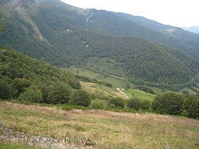 | ||
Col de la core pyr n es en juillet 2016
The Col de la Core (elevation 1,395 m (4,577 ft)) is a mountain pass in the Ariège department of France in the Pyrenees. It connects Audressein with Seix.
Contents
- Col de la core pyr n es en juillet 2016
- Map of Col de la Core 09140 Sentenac dOust France
- Ascension col de la core ariege
- Details of climb
- Appearances in Tour de France
- References
Map of Col de la Core, 09140 Sentenac-d'Oust, France
Ascension col de la core ariege
Details of climb
Starting from Audressein, the climb is 17.5 km (10.9 mi) long. Over this distance, the climb is 885 m (2,904 ft) (an average of 5.1%). The climb proper starts at Les Bordes-sur-Lez, from where it is 14.1 km at 5.7%, with the steepest section being at 8.0%.
Starting from Seix, the climb is 13.8 km (8.6 mi) long. Over this distance, the climb is 885 m (2,904 ft) (an average of 6.4%), with the steepest section being at 8.0%.
Appearances in Tour de France
The Col de la Core was first used in the Tour de France in 1984, since when it has featured six times, most recently in 2011, when the leader over the summit was Mickaël Delage.