
- elevation 2,172 ft (662 m) Basin area 3,763 km² Country United States of America | - elevation 2,129 ft (649 m) Length 60 km | |
 | ||
- left South Fork Coeur d'Alene River, Latour Creek - right North Fork Coeur d'Alene River - location | ||
Day trip to the coeur d alene river fly fishing for cutthroat
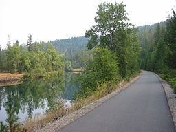
The Coeur d'Alene River flows 37 miles (60 km) from the Silver Valley into Lake Coeur d'Alene in the U.S. state of Idaho. The stream continues out of Lake Coeur d'Alene as the Spokane River.
Contents
- Day trip to the coeur d alene river fly fishing for cutthroat
- Map of Coeur dAlene River Idaho USA
- References
Map of Coeur d'Alene River, Idaho, USA
Before the Bunker Hill Smelter in the Kellogg area, which mined lead and silver, was forced to adopt environmental controls in the 1970s, there was so much lead in the river in the Kellogg area the locals called the stream "Lead Creek."
Salmon levels continue to remain high in the area (needs reference) and it is a popular destination for water-skiing, tubing, and swimming for locals.
All of the real bodies of water in the film Dante's Peak were either the Coeur d'Alene River or one of its tributaries, as Wallace, Idaho, where the movie was filmed, is in the Silver Valley.