
Province Ontario | ||
 | ||
Cochrane Road is a two-way Lower City collector road in Hamilton, Ontario, Canada. It starts off at the Queenston Traffic Circle and travels South between the Bartonville and Glenview neighbourhoods right through to the Rosedale neighbourhood where it ends at Greenhill Avenue in front of Rosedale Park. From this point onwards the road is now known as Whitehouse Road and weaves its way through King's Forest Golf Course and King's Forest Park.
Contents
- Map of Cochrane Rd Hamilton ON Canada
- History
- Landmarks
- Communities
- Intersecting streets
- Parallel streets
- References
Map of Cochrane Rd, Hamilton, ON, Canada
History
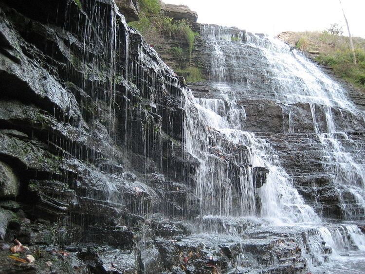
Albion Falls, a classical/cascade waterfall, and one of Hamilton's 100+ waterfalls, can be found here at the back-end of King's Forest Park. A nearby parking lot was removed when the construction of the nearby Red Hill Valley Parkway started. A parking lot at Mountain Brow Road above the falls for 50+ cars is still available for visitors. Up to the early 1900s a small vibrant village called Albion Mills was found here. The rocks from Albion Falls area were used to construct the Rock Garden at the Royal Botanical Gardens. Another waterfall can be found nearby, northwest of Albion Falls called, Buttermilk Falls. Not too far off and just East of the newly built Red Hill Valley Parkway at the Glendale Golf & Country Club is another waterfall called, Glendale Falls on Mount Albion Road.
King's Forest Golf Club was established in 1974 and is run by the city of Hamilton. The Red Hill Creek and many fair-sized ponds come into play. Credited as being one of the very best municipally owned courses in Canada.
Landmarks
Note: Listing of Landmarks from North to South.
Communities
Note: Listing of neighbourhoods from North to South
Intersecting streets
Note: Listing of streets from North to South.
Parallel streets
Note: Listing of streets from West to East.