
Country Brazil ZIP code 69460-000 Elevation 40 m Team Grêmio Atlético Coariense | Time zone AST(UTC-4 (UTC-4) Area 57,922 km² Local time Tuesday 7:16 PM | |
 | ||
Weather 26°C, Wind N at 5 km/h, 87% Humidity | ||
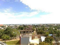
Coari (Choary) is a Brazilian municipality in the Amazon region.
Contents
Map of Coari - State of Amazonas, Brazil
Location
The municipal seat of Coari is one of the largest cities of the Amazonas state. It is the seat of the Roman Catholic Diocese of Coari. The area has reserves of oil and natural gas. Coari is served by Coari Airport located 6 km from downtown Coari. Porto Urucu Airport located in the district of Porto Urucu 470 km away serves the population residing and working for Petrobras.
Conservation
The municipality contains part of the Amanã Sustainable Development Reserve. It contains a small portion of the 1,008,167 hectares (2,491,230 acres) Piagaçu-Purus Sustainable Development Reserve, established in 2003. The municipality contains 66.15% of the 217,486 hectares (537,420 acres) Catuá-Ipixuna Extractive Reserve, established in 2003 as the first extractive reserve in the state of Amazonas.