
Status State-owned | Area 1,324 km² | |
 | ||
Location Saint Louis County, Minnesota, United States Governing body Minnesota Department of Natural Resources Website www.dnr.state.mn.us/state_forests/sft00013/index.html WWF classification Western Great Lakes forests | ||
The Cloquet Valley State Forest encompasses 327,098 acres (1,323.7 km2); 48,384 acres (195.8 km2) of which (or 15%) are Minnesota Department of Natural Resources forestry administered lands.
Map of Cloquet Valley State Forest, Whiteface Reservoir, MN 55803, USA
Located in southeast Saint Louis County, the Cloquet Valley State Forest is located about 20 miles (32 km) north of Duluth and 25 miles (40 km) southeast of Virginia, in Minnesota's Arrowhead region. It spreads out over east–central Saint Louis County, generally in areas just north of the city of Duluth, but extending into the valleys of the Ush-kab-wan River, Whiteface River, and Cloquet River, for which it is named. The city of Cloquet is located in adjacent Carlton County.
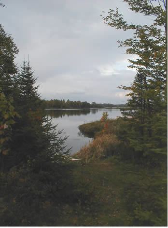
Recreational activities offered at the Indian Lake campground within the forest include camping, fishing, and a canoe route on the Cloquet River.
The Superior National Forest is located immediately north of the Cloquet Valley State Forest.
Saint Louis County Road 4 and County Road 44 are two of the main routes in the Cloquet Valley State Forest area. County Road 4 runs north–south through the middle of the forest between Island Lake and the community of Markham. County Road 44 runs north–south through the eastern portion of the forest, passing through the community of Brimson at the northeast corner of the forest.
County Road 52 runs east–west through the northwest part of the forest, east of Cotton, passing through the community of Whiteface.
County Road 49 runs east–west through the western portion of the forest. The majority of CR 49 is unpaved gravel surface.
Harris Road runs east–west through the southwest part of the forest. The entire route of Harris Road is unpaved gravel surface.
County Road 547 runs generally east–west through the northern portion of the forest in two separate segments. The first section of CR 547 runs between Whiteface towards Markham. The second section of CR 547 runs from near Markham to Brimson. The entire route of CR 547 is unpaved gravel surface.