
First recorded Mid 17th Century Irish grid ref W466733 Civil parish Magourney | ||
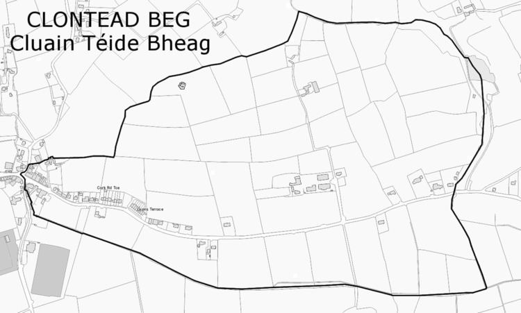 | ||
Clontead Beg (from Irish Cluain Téide Bheag) is a townland within the civil parish of Magourney and catholic parish of Aghabullogue, County Cork, Ireland. It is 227.39 acres in size, and east of Coachford village.
Contents
Map of Clontead Beg, Co. Cork, Ireland
In the Down Survey (Muskery Map, 1656-8), it is referred to as 'Clonete Beg', but does not appear as a 'denomination' on the Down Survey parish map, nor is it mentioned in the accompanying terrier.
The Ordnance Survey name book (c. 1840) describes the western end of the townland as forming the village of Coachford and the eastern end the 'Derreen Demesne.' Clontead House and Demesne was situated on its southern boundary. Various name versions are given, such as 'Clontade', 'Clontead', 'Clontadebeg' and 'Clontade Beg'. A suggested Irish version is Cluain Téide Beg, with 'Cluain Téide' interpreted as 'plain or lawn of the green [hill]'. O'Murchú (1991) gives an Irish version of Cluain Téide, suggesting 'Téide' as meaning a plateau, or a plain on a hill; essentially 'plain of the flat-topped hill'. The Placenames Database of Ireland gives the townland an Irish name of Cluain Téide Bheag, with 'Cluain' meaning 'meadow' or 'pasture'.
Townlands vary greatly in size, being territorial divisions within parishes in Ireland. Extensively used for land surveys, censuses and polling systems since the seventeenth century, townlands have also been used as the basis for rural postal addresses. In County Cork, surveying and standardisation of townland names and boundaries by the Ordnance Survey during the mid-nineteenth century, resulted in some earlier townland names disappearing, due to amalgamation or division. The townlands resulting from such surveys were employed during the Primary Land Valuation (Griffith's Valuation), subsequent censuses, and continue in use today.