
OS grid NB154073 Elevation 799 m Listing Marilyn | Topo map OS Landranger 13 or 14 Prominence 799 m | |
 | ||
Similar Seaforth Island, Beinn Mhòr, Beinn an Òir, Askival, Broad Law | ||
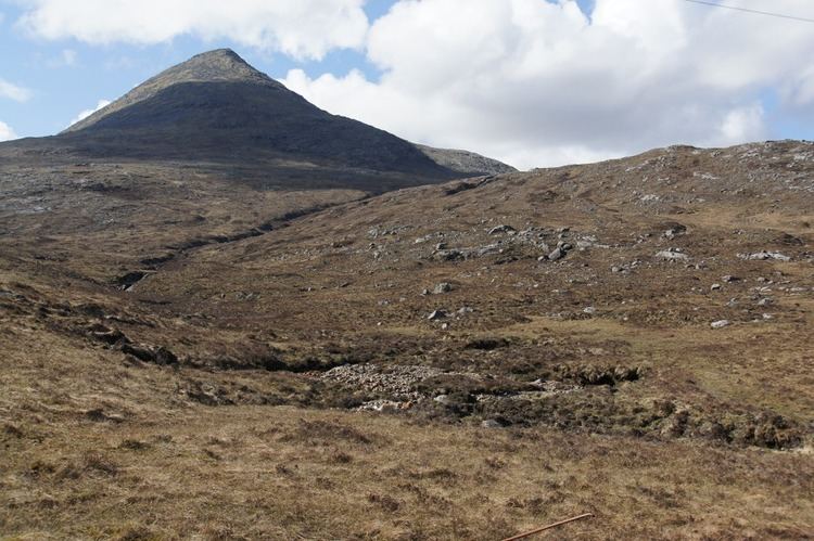
Clisham isle of harris
The Clisham (Scottish Gaelic: An Cliseam) is a mountain on the island of Harris in the Western Isles of Scotland. At 799 metres (2,621 ft) it is the highest mountain in the Outer Hebrides and the archipelago's only Corbett.
Contents
- Clisham isle of harris
- Map of Clisham Isle of Harris UK
- Isle of harris isle of lewis wild camping in scotland clisham
- References
Map of Clisham, Isle of Harris, UK
The easiest ascent of the mountain starts from the highest point of the A859 road between Tarbert and Ardvourlie (Aird a' Mhulaidh), and climbs the broad southern shoulder. A longer and more varied expedition starts at a bridge over the Scaladale River (Abhainn Scaladail) near Ardvourlie, from where the minor summit of Tomnabhal (552 metres (1,811 ft)) may be ascended before continuing on to the Clisham. Many walkers taking this option continue west then north along the ridge, taking in the summits of Mull bho Dheas (743 metres (2,438 ft)), Mulla bho Thuath (720 metres (2,362 ft)) and Mullach an Langa (614 metres (2,014 ft)), thus completing a round known as the Clisham Horseshoe.