
J F M A M J | F M A M J J | |
 | ||
Miami has a tropical monsoon climate (Köppen climate classification Am) with hot and humid summers and short, warm winters, with a marked drier season in the winter. Its sea-level elevation, coastal location, position just above the Tropic of Cancer, and proximity to the Gulf Stream shape its climate.
Contents
With January averaging 69.2 °F (20.7 °C), winter features warm temperatures; cool air usually settles after the passage of a cold front, which produces much of the little amount of rainfall. Lows sometimes fall to or below 50 °F (10 °C), with an average 3 such occurrences annually, but very rarely 40 °F (4 °C); from 1981 to 2010, temperatures reached that level in only eight calendar years. Highs generally reach 70 °F (21 °C) or higher, and fail to do so on only an average of 12 days annually.
The wet season usually begins during the month of May and continues through mid-October. During this period, temperatures are in the mid 80s to low 90s (29–35 °C), accompanied by high humidity, though the heat is often relieved by afternoon thunderstorms or a sea breeze that develops off the Atlantic Ocean, which then allow lower temperatures, but conditions still remain very muggy. Much of the year's 61.9 inches (1,570 mm) of rainfall occurs during this period.
Extreme temperatures range from 26.5 °F (recorded as 27 in the almanac) on February 3, 1917, to 100 °F on July 21, 1942, (−2.8 to 38 °C), the triple-digit (°F) reading on record; the more recent freezing temperature seen at Miami International Airport was on December 25, 1989. The highest daily minimum temperature is 84 °F (29 °C) on August 4, 1993 and September 7, 1897 (although the corresponding record for Miami Beach is 90 °F or 32 °C on July 17, 2001), and conversely, the lowest daily maximum temperature is 45 °F (7 °C) on February 19, 1900.
While Miami has never officially recorded any accumulating snowfall since records have been kept, there were dubious claims of snow flurries on January 19, 1977 during the cold wave of January 1977. Weather conditions for the area around Miami were recorded sporadically from 1839 until 1900, with many years-long gaps. A cooperative temperature and rainfall recording site was established in what is now Downtown in December 1900. An official Weather Bureau Office opened in Miami in June 1911. Heavy snow squalls with accumulations that lasted for a few hours after the snow had stopped falling in February 1899 were reported, but these are not official since there is no written record of it.
Miami receives abundant rainfall, one of the highest among major cities in the United States. Most of this rainfall occurs from mid-May through early October. Miami has an average annual rainfall of 61.9 inches (1,570 mm), whereas nearby Fort Lauderdale and Miami Beach receive 66.5 inches (1,690 mm) and 51.7 inches (1,310 mm), respectively, which demonstrates the high local variability in rainfall rates.
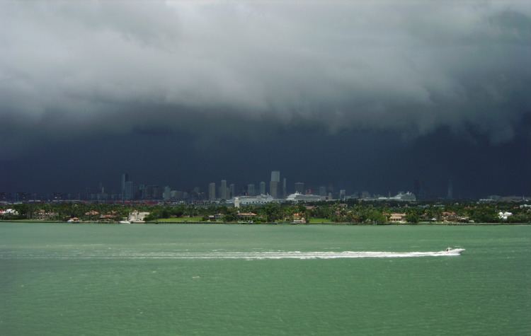
Miami reports more thunderstorms than most US cities, with about eighty days per year having thunder reported. These storms are often strong, with frequent lightning and very heavy rain. Occasionally, they can be severe with damaging straight line winds and large hail. Tornadoes and waterspouts sometimes occur, although violent tornadoes of the type seen in other parts of the United States are rare in Florida.
During El Niño events, Miami becomes cooler than normal during the dry season with above average precipitation. During La Niña, Miami becomes warmer and drier than normal.
A record setting 12-day cold snap in January 2010 was the coldest period since at least the 1940s. During the cold wave of January 1977 that saw snowfall over the majority of the state, isolated flurries have been observed on the outskirts of Miami, which is the only recorded snowfall in the history of the region.
The climate for much of the state is humid subtropical (Köppen Cfa), South Florida, as well as all of the Florida Keys, qualify as one of several tropical classifications (Köppen Aw, Am, or Af). Southeastern Florida falls into USDA zone 10b for plant hardiness, where annual extreme low temperatures range from 30 to 40 °F (−1 to 4 °C), versus zone 9 in Central Florida, and zone 8 in northern Florida. With global warming, the urban heat island effect, as well as Biscayne Bay as a buffer, the waterside downtown area and the barrier islands including Miami Beach made it into hardiness zone 11a by 2012. Miami Beach has virtually no freezing weather in its history and very few sub-40 °F (4 °C) weather. Roughly 115 miles (185 km) north of Miami, Jensen Beach is at the threshold of Florida's tropical climate designation, with January having an average about 64 °F (18 °C). Southeastern Florida is also the only area in the continental United States to be in Zone 1 for Energy Star recommended insulation levels, with Hawaii, Puerto Rico, and the US Virgin Islands.
Tables
This chart shows the average coastal ocean water temperature by month in degrees Fahrenheit for Miami Beach based on historical measurements.
Hurricanes
The Atlantic hurricane season officially runs from June 1 through November 30, although hurricanes can develop beyond those dates. The most likely time for Miami to be hit is during the peak of the Cape Verde season which is mid-August through the end of September. Due to its location between two major bodies of water known for tropical activity, Miami is also statistically the most likely major city in the world to be struck by a hurricane, trailed closely by Nassau, Bahamas, and Havana, Cuba. Despite this, the city has been fortunate in not having a direct hit by a hurricane since Hurricane Cleo in 1964. However, many other hurricanes have affected the city, namely the Great Miami Hurricane in 1926, Betsy in 1965, Andrew in 1992, Irene in 1999, and Hurricanes Katrina and Wilma in 2005. At least 35 direct and 26 indirect deaths in Florida were attributed to Wilma.
In addition, a tropical depression in October 2001 passed over the city, causing record rainfall and flooding. Locally, the storm is credited as the No Name Storm of 2000, though the depression went on to become Tropical Storm Leslie upon entering the Atlantic Ocean.
A hurricane, known as the "Great Miami Hurricane of 1926," caused catastrophic damage to the heavily developed Miami and Miami Beach area. Hurricane Betsy passed over Key Largo, south of the city, but did cause hurricane-force winds and very heavy rainfall there. Hurricane Andrew in 1992 also struck south of city and caused extensive damage and flooding in the Homestead area suburbs. Hurricane Wilma in 2005 caused severe damage to many high-rise buildings in the downtown area as it broke many windows out, which in turn caused bad water damage on the insides of the buildings. It also caused at least 35 direct and 26 indirect fatalities in Florida.
Miami has been identified as one of three cities in the United States most vulnerable to hurricanes, mainly due to its location and it being surrounded by ocean and low-lying coastal plains, the other two cities being New Orleans and New York City.