
Elevation 221 m (725 ft) Population 14,151 (2016) Local time Monday 7:10 PM | County Simcoe Postal code FSA L0M Area code Area codes 705 and 249 Province Ontario | |
 | ||
Established January 1, 1994 (1994-01-01) Weather 5°C, Wind SE at 14 km/h, 72% Humidity | ||
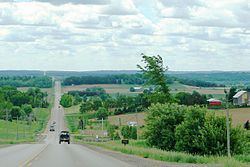
Clearview is an incorporated township in Simcoe County in Central Ontario, Canada, west of Barrie and south of Collingwood and Wasaga Beach in Simcoe County.
Contents
- Map of Clearview ON Canada
- History
- Geography and climate
- Economy
- Government
- Education
- Infrastructure
- Notable attractions
- References
Map of Clearview, ON, Canada
History
Clearview Township was established on January 1, 1994, when the Town of Stayner, the Village of Creemore and the Townships of Nottawasaga and Sunnidale were amalgamated. The Townships of Nottawasaga and Sunnidale were incorporated in 1851 and 1858, respectively.
Early settlement on the site of Stayner coincided with the construction of a railway line from Toronto to Collingwood, Ontario between 1851 and 1855. The community of Stayner, which was originally called Nottawasaga Station, developed into a significant agricultural and lumbering centre. Stayner was incorporated as a village in 1872, and as a Town in 1888. The Village of Creemore was incorporated effective 20 November 1889.
Geography and climate
The township comprises the communities of Avening, Batteaux, Brentwood, Cashtown Corners, Creemore, Dunedin, Duntroon, Glen Huron, Maple Valley, New Lowell, Nottawa, Pretty River Valley, Smithdale, Stayner, Sunnidale, Sunnidale Corners and Websterville.
It borders on the following municipalities:
Clearview (and Simcoe County in general) is part of Central Ontario as well as the Georgian Triangle. The climate in the area is classified as Humid Continental (Warm Summer Subtype).
Located in the Great Lakes lowlands, it has fertile soil quite suitable for farming. As a result of the proximity to the Great Lakes it suffers from Lake Effect.
Economy
As of 2006, compared to Ontario as a whole, Construction, Agriculture, and Manufacturing industries employ a greater than average percentage of the workforce (Business, Finance and Real Estate employ smaller than average). The employment rate was 67.1% (62.8% for Ontario) and the unemployment rate was 4.5% (6.4% for Ontario). 40% of the workforce worked outside the municipality and 13% worked from home.
The well-known Creemore Springs Brewery is located in Creemore.
Health Canada medical marijuana licensed producer The Peace Naturals Project produces their medicinal Cannabis in Clearview Township.
The Stayner Sun is the township's newspaper of record. It has published continually since 1877. The newspaper is owned by Metroland Media Group.
Government
The township is administered by a Town Council with one member from each of the seven (numbered) wards, a Mayor and Deputy-mayor.
The administration of the town is divided into the Departments of Finance, Planning and Development, Public Works, an Administration staff as well as the Public Library and Fire Department. All the main administrative buildings of Clearview are located in Stayner.
The 2010 budget for the township is $17,470,379.
Education
Clearview township is served by the Simcoe County District School Board (SCDSB), Simcoe Muskoka Catholic District School Board (SMCDS) and the French Catholic School Board Conseil scolaire de district catholique Centre-Sud. A number of schools, although located in other municipalities (specifically Collingwood and Wasaga Beach), have catchment areas that extend into Clearview.
While there is no post-secondary education in Clearview itself, the main campus of Georgian College is in nearby Barrie with a satellite campus in Collingwood nearby.
The Clearview Public Library maintains branches in Stayner, Creemore and New Lowell.
Infrastructure
Major roads in Clearview include Highway 26, Hurontario Street (former Highway 24), Airport Road, as well as County Roads 7, 9, 10, and 91. Despite its name, Collingwood Airport is also located in Clearview.
Clearview is served by Collingwood General And Marine Hospital in Collingwood. Policing services are provided by the Huronia West detachment of the OPP out of Wasaga Beach. Fire protection is provided by volunteer fire stations located throughout the township.
There are 2 Arenas (Stayner, Creemore), 3 Baseball Parks (Nottawa, Stayner, with the largest being in New Lowell) and 2 Golf Courses (Duntroon Highlands, Batteaux Creek Golf Club) in Clearview. Devil's Glen Provincial Park and Carruther's Memorial Conservation Area as well as the Mel McKean Memorial Park, Gowan Memorial Park, Ives Park, Kinsmen Participark, and Legion Park are also located there. There is also a small conservation area with a large pond in the village of New Lowell.