 | ||
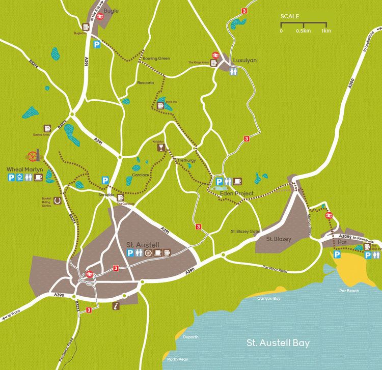
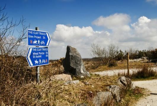
The Clay Trails are a series of bicycle trails located in mid Cornwall, England, United Kingdom. The trails pass through the St Austell moorland which for over two centuries has been entensively quarried for china clay, hence the name.
Contents
- St austell clay trails by drone
- The Wheal Martyn trail 8Km
- The St Austell trail 25Km
- The Bugle trail 6Km
- The St Blazey trail 5Km
- References
The trails are separated into several routes.
St austell clay trails by drone
The Wheal Martyn trail - 8Km
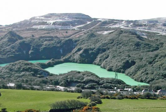
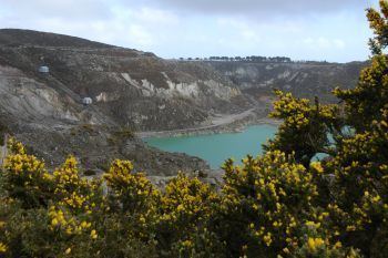
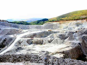
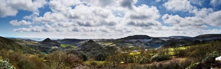
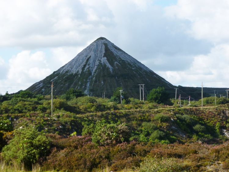
This trail connects the Eden project 50.361°N 4.745°W / 50.361; -4.745 to the Wheal Martyn China Clay museum. This also incorporates a short section of trail called the sky spur trail. The trail gives spectacular views of several disused china clay pits with white walls and turquoise water. A prominent feature of the trail is the white pyramid, although it's now green, which is a disused china clay tip in which the waste sand has been tipped to form a conical hill. The trail then drops into the Trenance valley where it crosses its award winning William Cookworthy bridge. Here it joins the Lansalson branch line and is joined by the St Austell trail. A further kilometre through this historic valley is the Wheal Martyn China clay museum.
The St Austell trail - 2.5Km
This connects the town of St Austell 50.338°N 4.793°W / 50.338; -4.793 to the Wheal Martyn trail, this section follows the route of the disused Lansalson branch line along the Trenance valley and on its route passes many historical sites. At the beginning of the trail excellent views of the curved viaduct carrying the Cornish main line railway can be seen. A kilometre from the entrance to the trail is the disused Carlyon Farm china clay dries which are the largest of their type in Europe.
The Bugle trail - 6Km
This connects the village of Bugle 50.395°N 4.793°W / 50.395; -4.793 to the Eden project.
The St Blazey trail - 5Km
This connects the Eden Project to Par beach via St Blazey 50.362°N 4.717°W / 50.362; -4.717.