
Area 1,077 km² Population 20,408 (2013) Unemployment rate 9.4% (Apr 2015) | Founded 1871 Cities West Point | |
 | ||
Website www.claycountyms.com/index.php/ Rivers Tibbee Creek, Tombigbee River, Buttahatchee River | ||
Clay County is a county located in the U.S. state of Mississippi. As of the 2010 census, the population was 20,634. Its county seat is West Point. Its name is in honor of American statesman Henry Clay, member of the United States Senate from Kentucky and United States Secretary of State in the 19th century.
Contents
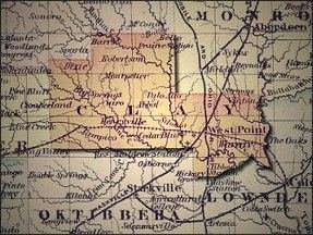
- Map of Clay County MS USA
- Geography
- Major highways
- Adjacent counties
- National protected area
- Demographics
- Education
- Cities
- References
Map of Clay County, MS, USA
The federal government formerly designated Clay County as the West Point Micropolitan Statistical Area, but the county lost that status in 2013. It is part of the Golden Triangle region of the state.
Geography
According to the U.S. Census Bureau, the county has a total area of 416 square miles (1,080 km2), of which 410 square miles (1,100 km2) is land and 5.9 square miles (15 km2) (1.4%) is water.
Major highways
Adjacent counties
National protected area
Demographics
As of the 2010 United States Census, there were 20,634 people residing in the county. 58.2% were Black or African American, 40.5% White, 0.2% Asian, 0.1% Native American, 0.3% of some other race and 0.6% of two or more races. 1.0% were Hispanic or Latino (of any race).
As of the census of 2000, there were 21,979 people, 8,152 households, and 5,885 families residing in the county. The population density was 54 people per square mile (21/km²). There were 8,810 housing units at an average density of 22 per square mile (8/km²). The racial makeup of the county was 42.82% White, 56.33% Black or African American, 0.05% Native American, 0.16% Asian, 0.01% Pacific Islander, 0.21% from other races, and 0.42% from two or more races. 0.86% of the population were Hispanic or Latino of any race.
According to the census of 2000, the largest ancestry groups in Clay County were African 56.3%, English 35% and Scots-Irish 4.5%.
There were 8,152 households out of which 35.70% had children under the age of 18 living with them, 45.80% were married couples living together, 22.40% had a female householder with no husband present, and 27.80% were non-families. 25.50% of all households were made up of individuals and 11.00% had someone living alone who was 65 years of age or older. The average household size was 2.64 and the average family size was 3.19.
In the county, the population was spread out with 28.80% under the age of 18, 10.40% from 18 to 24, 26.50% from 25 to 44, 21.10% from 45 to 64, and 13.10% who were 65 years of age or older. The median age was 34 years. For every 100 females there were 89.10 males. For every 100 females age 18 and over, there were 83.60 males.
The median income for a household in the county was $27,372, and the median income for a family was $35,461. Males had a median income of $30,038 versus $19,473 for females. The per capita income for the county was $14,512. About 19.20% of families and 23.50% of the population were below the poverty line, including 34.20% of those under age 18 and 21.90% of those age 65 or over.
Education
Clay County is within the service area of the East Mississippi Community College system.