
Country United States FIPS code 21-15202 Area 230 ha Zip code 42404 Population 1,168 (2013) | Time zone Central (CST) (UTC-6) GNIS feature ID 0489565 Elevation 116 m Local time Monday 3:59 PM Area code 270 | |
 | ||
Weather 17°C, Wind S at 21 km/h, 81% Humidity | ||
Clay is a home rule-class city in Webster County, Kentucky, in the United States. The population was 1,179 at the 2000 census. Settled in 1837, the city is named for the statesman Henry Clay.
Contents
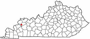
Map of Clay, KY 42404, USA
Geography
Clay is located at 37°28′41″N 87°49′15″W.
According to the United States Census Bureau, the city has a total area of 0.9 square miles (2.3 km2), all land.
History
A post office was established in 1837 when the community was called Ashland, for Henry Clay's Lexington estate. It was renamed Clay in 1854.
Demographics
As of the census of 2000, there were 1,179 people, 485 households, and 333 families residing in the city. The population density was 1,300.9 people per square mile (500.2/km²). There were 541 housing units at an average density of 596.9 per square mile (229.5/km²). The racial makeup of the city was 99.15% White, 0.25% African American, 0.17% Asian, 0.17% Pacific Islander, and 0.25% from two or more races. Hispanic or Latino of any race were 0.34% of the population.
There were 485 households out of which 31.1% had children under the age of 18 living with them, 55.9% were married couples living together, 9.1% had a female householder with no husband present, and 31.3% were non-families. 29.3% of all households were made up of individuals and 15.7% had someone living alone who was 65 years of age or older. The average household size was 2.43 and the average family size was 2.99.
In the city, the population was spread out with 24.8% under the age of 18, 7.8% from 18 to 24, 30.8% from 25 to 44, 21.4% from 45 to 64, and 15.3% who were 65 years of age or older. The median age was 37 years. For every 100 females there were 97.2 males. For every 100 females age 18 and over, there were 92.0 males.
The median income for a household in the city was $31,625, and the median income for a family was $42,500. Males had a median income of $30,729 versus $16,538 for females. The per capita income for the city was $15,545. About 10.7% of families and 13.3% of the population were below the poverty line, including 23.1% of those under age 18 and 10.1% of those age 65 or over.
The city was featured in The Statler Brothers' song "How are Things in Clay, Kentucky?" (1980).
Education
Clay Elementary School serves students Pre-School-8. In the late 1990s a new gym and cafeteria were built for the school.