
Population (1999) 233 Area 6.96 km² | Canton Aire-sur-la-Lys Time zone CET (UTC+1) Local time Monday 5:26 PM | |
 | ||
Weather 8°C, Wind W at 21 km/h, 77% Humidity | ||
Clarques is a former commune in the Pas-de-Calais department in the Hauts-de-France region of France. On 1 January 2016, it was merged into the new commune Saint-Augustin.
Contents
Map of 62129 Clarques, France
Geography
A farming village situated 8 miles (13 km) south of Saint-Omer, on the D190 and D192 road junction. The A26 autoroute passes by the commune just 200 yards (180 m) away.
Places of interest
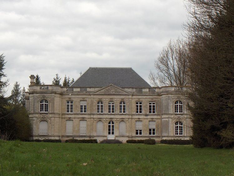
The present chateau was built in the early 1780s by Augustin Titelouze de Gournay, a king’s musketeer, before his marriage to Marie-Therese de Feuchin in 1788. The house was enlarged in 1905 by Joseph de Gournay from the plans of architect Lillois Vilain, adding the protruding wings.
References
Clarques Wikipedia(Text) CC BY-SA