
Founded 1752 FIPS code 24-17350 Zip code 20871 Area code Area codes 240 and 301 | Time zone Eastern (EST) (UTC-5) Elevation 202 m Population 13,677 (2010) | |
 | ||
Country United States of America Area 21.5 km² (21.24 km² Land / 26 ha Water) | ||
Clarksburg is a census-designated place and an unincorporated area in northern Montgomery County, Maryland, United States, located along the Interstate 270 technology corridor about 4 miles north of Germantown, MD. As of Census 2010 its population was 13,766.
Contents
- Map of Clarksburg MD USA
- Geography
- Demographics
- History
- Development
- School enrollment
- Businesses and Organizations
- References
Map of Clarksburg, MD, USA
Geography
As an unincorporated area, Clarksburg's boundaries are not officially defined. Clarksburg is, however, recognized by the United States Census Bureau as a census-designated place, and by the United States Geological Survey as a populated place.
According to the United States Census Bureau, it has a total area of 8.3 square miles (21 km2), of which, 8.2 square miles (21 km2) of it is land and 0.1 square miles (0.26 km2) of it (1.82%) is water.
Demographics
As of the 2010 census, there were 13,766 people and 4,352 households residing in the area. The population density was 1,667.9 people per square mile (51.2/km²). The population is roughly 44.1% White, 14.7% African-American, 0.1% American Indian or Alaska Native, 33.6% Asian, 0.1% Native Hawaiian or Pacific Islander, including 9.8% of the population Hispanic or Latino origin of any race.
In 2000 there were 604 households, out of which 42.1% had children under the age of 18 living with them, 72.0% were married couples living together, 6.6% had a female householder with no husband present, and 17.5% were non-families. 13.9% of all households were made up of individuals and 4.6% had someone living alone who was 65 years of age or older. The average household size was 3.04 and the average family size was 3.34.
In the area, the population was spread out with 29.3% under the age of 18, 4.8% from 18 to 24, 29.7% from 25 to 44, 27.4% from 45 to 64, and 8.8% who were 65 years of age or older. The median age was 38 years. For every 100 females there were 100.2 males. For every 100 females age 18 and over, there were 103.6 males.
The median income for a household in the CDP was $88,419, and the median income for a family was $91,216. Males had a median income of $63,125 versus $42,283 for females. The per capita income for the area was $33,174. About 3.4% of families and 4.6% of the population were below the poverty line, including 6.3% of those under age 18 and 6.8% of those age 65 or over.
History
Clarksburg is named for trader John Clarke, and was established at the intersection of the main road between Georgetown and Frederick and an old Seneca trail. One of its earliest white inhabitants was a man named Michael Ashford Dowden, who in 1752 received a patent for 40 acres (160,000 m2) from the colonial government called "Hammer Hill", and two years later permission to build an inn. The inn itself is a footnote in history, hosting the army of General Edward Braddock during the French and Indian War, serving as a meeting place for local Sons of Liberty in the years before the American Revolution, and possibly serving dinner to President Andrew Jackson on his way to his inauguration. Jamie, grandson of the trader, built a general store in the area around 1770, and over the next thirty years enough people moved to the area that Clark was appointed postmaster for the community. By 1875, Clarksburg was a major town in the northern part of the county, but the construction of the Baltimore and Ohio Railroad undermined its economy.
In 1964, the Montgomery County planning commission decided that Clarksburg would be the last community along Interstate 270 that would have large-scale development. The Montgomery County Council adopted a master plan for Clarksburg in 1968, which rezoned land for a mix of townhouses and single-family houses. Another master plan was adopted in 1994. A retail area was planned to be built in Clarksburg, but retail development had not broken ground by 2010, to the dismay of some residents. A Harris Teeter-anchored shopping center opened in 2013, and a large outlet mall opened in October 2016.
In June 2015, the Clarksburg Chamber of Commerce selected the town's flag designed by Shaneea Peek as the official flag of Clarksburg.The inspiration of the flag was derived from Dowden’s Ordinary which is a historic landmark of Clarksburg.
Development
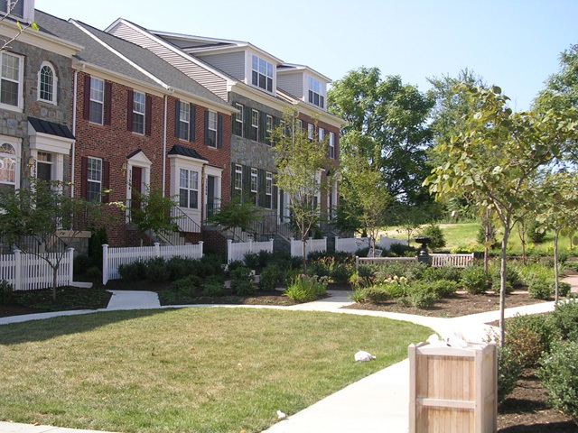
Since 2000 there has been major growth in the area of Clarksburg. A new town center is being built in the heart of Clarksburg, near the historic center. 2010 Census data show that there are now over 13,677 residents and 4,352 households currently residing in Clarksburg, which consists of a diverse population with a high level of education attainment. Several public parks and schools have also been developed to help accommodate the growth. In recent years it was discovered that many new houses have had been built closer together than the minimum distance required by zoning laws, roads built too narrow for firetrucks to pass, homes and community facilities built without adequate permits or approvals by local authorities. This was found to be the fault of inadequate county oversight and lax enforcement of building codes and laws combined with a building boom in the early 2000s.
Clarksburg has a park and children's playground named Park Daniel, and Little Bennett Regional park is nearby.
School enrollment
The two newest schools, Little Bennett Elementary School and Clarksburg High School, have the largest increase of students, with Little Bennett at 71.4% above building capacity in the projections of 2011-2012. This has led to a moratorium in issuance of permits for new projects, but not issuance of permits in existing projects, for new homes in the Clarksburg area. The majority of planned housing units will be built in existing projects. All four of the largest neighborhoods are exempt from the moratorium.