
Country United States FIPS code 51-16880 Elevation 38 m Zip code 23899 Population 363 (2013) | Time zone Eastern (EST) (UTC-5) GNIS feature ID 1464932 Area 6.5 km² Local time Monday 8:32 AM Area code 757 | |
 | ||
Weather 4°C, Wind S at 11 km/h, 63% Humidity | ||
Claremont is an incorporated town in Surry County, Virginia, United States. The population was 343 at the 2000 census.
Contents
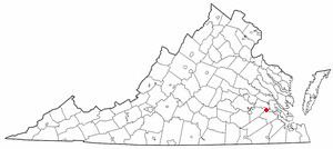
Map of Claremont, VA, USA
History
A granite marker in a circle in the center of town commemorates the landing here on May 5, 1607, of English settlers. Beginning in the late 17th and early 18th centuries, Claremont was a busy port town on the navigable portion of the James River, shipping many goods, but especially hogsheads of tobacco.
After the Civil War, Willie Allen, who inherited Claremont Manor, moved to New York and sold the property. J. Frank Mancha, a Maryland real estate developer took on the project to develop, subdivide and colonize a new town there in 1879. Incorporated in 1886, the town of Claremont became the eastern terminus of the new Atlantic and Danville Railway (A&D), a narrow gauge railroad, which was completed to a point near Emporia called James River Junction, where it connected with a standard gauge track towards Danville. Unfortunately for Claremont, the A&D decided to connect its western leg with a new eastern terminus in West Norfolk on the harbor of Hampton Roads, and the line to Claremont, which was never standard-gauged, went into semi-abandonment. After some use for lumber transport, the rails were removed in the 1930s.
In the years since, the area has remained as a rural enclave, but some resort use developed along the bluffs and beaches of the James River. At the lower of these two levels, Claremont's Sunken Meadow section along the riverfront was badly damaged in 2003 by Hurricane Isabel.
In 2006, the old A&D station at Claremont Beach (village, not the wharf) was still standing.
Geography
Claremont is located at 37°13′38″N 76°57′56″W (37.227291, -76.965458).
According to the United States Census Bureau, the town has a total area of 2.5 square miles (6.6 km²), all of it land.
Demographics
As of the census of 2000, there were 343 people, 147 households, and 99 families residing in the town. The population density was 135.3 people per square mile (52.1/km²). There were 240 housing units at an average density of 94.6 per square mile (36.5/km²). The racial makeup of the town was 73.18% White, 22.74% African American, 2.04% Native American, and 2.04% from two or more races.
There were 147 households out of which 23.1% had children under the age of 18 living with them, 53.7% were married couples living together, 9.5% had a female householder with no husband present, and 32.0% were non-families. 27.9% of all households were made up of individuals and 11.6% had someone living alone who was 65 years of age or older. The average household size was 2.33 and the average family size was 2.83.
In the town, the population was spread out with 19.8% under the age of 18, 5.8% from 18 to 24, 25.7% from 25 to 44, 31.5% from 45 to 64, and 17.2% who were 65 years of age or older. The median age was 44 years. For every 100 females there were 92.7 males. For every 100 females age 18 and over, there were 92.3 males.
The median income for a household in the town was $34,643, and the median income for a family was $46,667. Males had a median income of $42,250 versus $30,000 for females. The per capita income for the town was $22,741. About 6.3% of families and 7.5% of the population were below the poverty line, including none of those under age 18 and 10.2% of those age 65 or over.