
Population 1,088 (2011) District Bassetlaw | OS grid reference SK731832 Sovereign state United Kingdom Civil parish Welham | |
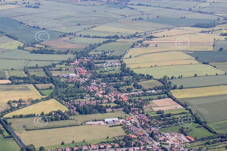 | ||
Clarborough is a village in the civil parish of Clarborough and Welham, in the district of Bassetlaw, Nottinghamshire, England. Clarborough is located 2 miles (3 km) north-east from the centre of Retford. The population of the civil parish as taken at the 2011 Census was 1,088.
Contents
Map of Clarborough, Retford, UK
History
Clarborough is listed in the 1086 Domesday Book as "Claueburch" or "Claureburg." The chief value of the village was its land. Because of the village's geographical position, being at the foot of Clarborough Hill, land was useful for agriculture, including grazing. By 1769 Clarborough was written on maps as "Charlborough".
A post windmill was located on Clarborough Hill. It was standing in 1753, but burnt down in 1896.
Occupations
During the period of the late 19th century, the 1881 Census provided information on the occupation classification of the inhabitants of Clarborough. This data helps to give an insight of the history of the area. The central field of employment for males during this era was in agriculture, with 667 males working within this field. Although a great number (145) were employed within the field entitled 'Wrks in Var. Mineral Substances', this could be explained through the location of Clarborough being in the Midlands, and during this time miners were in great demand, due to the volume of demand. The number of males employed within the 'professionals' field was significantly lower, standing at only 28.
The 1881 Census also provided information on the female occupations, with the majority (889) being categorised with an 'Unknown Occupation'. This may be seen as stereotypical for this era as it would primarily be the males in the family who earned the living. Nevertheless, this data also provides evidence stating that 385 females worked within the 'Domestic Services or Offices' grouping. Although, this is quite a minor percentage of the population of the population at this time as the 1881 Census states the population of Clarborough to be 6,290.
The village of Clarborough may have been classified with a lower class status due to the occupations found, with the vast majority of the village working in a primary field, rather than tertiary such as the level of 'Professionals' found was significantly lower compared to those working in 'Agriculture'.
As transport links improved and personal transport became the norm, Clarborough developed through the latter part of the 20th century with major employment opportunities developing at local power stations as well as public sector employers such as education, police and prison service. Improvements to the railway network, particularly the East Coast Main Line through Retford that links Edinburgh and Leeds with London, also increased property prices as commuting became more feasible.
Population
Population change in Clarborough has followed a similar trajectory to that of England as a whole, although there has been a greater amount of fluctuation. One reason for this is that Clarborough has a smaller population, therefore any change would be more recognisable. In 1881 there was a national decline in population change with England overall declining by 3%, whereas Clarborough declined overall by 6%, reaching its lowest rate of change being −3%. Since this period the population has peaked higher than the original rate to 6% in 1901, and has remained steadily in parallel with the rest of England and Wales.
The population density for England and Wales has remained at a steady rate. Although, there is a clear positive correlation, as in 1881 the national rate of population density was 0.7%, however it has increased slightly to 0.95% in 1901. Whereas, the population density in Clarborough has remained at a steady rate of 0.25% from 1881 to 1901.
The parish was effectively cut in two in 1934 when the chapel of ease of St Saviour's was designated a parish in its own right.
The civil parish of Clarborough and Welham had a population of 1,111 in the 2001 Census.
Community
The parish church is dedicated to John the Baptist.
According to the 2001 Census, Clarborough had 481 dwellings, 290 of these dwellings are in the detached housing category, with 186 being semi-detached and terraced houses and 5 being categorised as flat maisonettes or apartments. The average property price in Clarborough is £230,292, whereas the national average is £161,588.
To the south of the village is the hamlet of Welham, where is situated Welham Grange, an intact house dating from 1667 which listed as a Grade II building by the English Heritage on 1 February 1967. Also in Welham is the early 19th-century Welham Hall. Welham is listed in Domesday as "Wellun" (meaning 'at the spring').
Education
An elementary school was extant by 1 May 1871 and extracts from its Log Books suggest that the school might have been in existence before that date.
The school's capacity proved inadequate by the late 1950s. Initially this was addressed by an expansion of the Victorian buildings adjacent to the church of St. John the Baptist on Church Lane. However, as the village continued to expand through the 1960s, this too proved inadequate such that Nottinghamshire Councty Council initiated a proposed 2-phase development. The first phase, on newly created Hillview Crescent just off Main Street (the A620), was opened in 1970 and accommodated the junior classes – the Victorian building continuing to house older pupils. Phase 2 of this development was never carried forward as economic conditions of the early 1970s made it unaffordable.
By the 2000 conditions in both the Hillview Crescent building and the expanded Church Lane site made redevelopment a priority such that Nottinghamshire County Council announced plans to create a new building adjacent to the Hillview Crescent site as a single centre for primary education in Clarborough. The plans would see the demolition of the 1960s building and sale of the Church Lane site (still not accomplished in late 2013). The plans for the new building needed significant modification following serious flooding of that part of the village in July 2005, but the building was opened in September 2008 to accommodate all pupils of the school.
Transport
Transport links to and from Clarborough have always been few, because of the insignificant need to invest in major links, with such a small number of inhabitants moving regularly through the village.
The main changes in transport for Clarborough occurred in 1777, when the Chesterfield Canal was opened, providing navigation to the River Trent. This was the beginning of a period where Clarborough was being brought into the wider communication network, with and upgraded national road network, and the introduction of turnpike highways which allowed transport from Clarborough to larger towns such as Retford. One highway (1824–76), ran from Spital Hill at Retford to Clarborough, providing better links to nearby villages and towns. The new highways, and the canal, might have moved the centre of gravity of the village, today away from the church and towards the main roads.
A railway line was by 1849 running at the southern side of the village through the neighbouring hamlet of Welham. The railway allowed links to Lincolnshire and cities such as Manchester and Sheffield.
With the increase in motor transport in the 20th century, the main road through Clarborough and Welham (A620) was improved although low bridges on the already established railway line gave problems for traffic. The alternative route around the village (Tiln Lane/Smeath Lane) is not suited to heavy vehicles which use it.