
Demonym(s) Civitonici Postal code 01033 Patron saint John and Marcianus | Elevation 145 m (476 ft) Local time Monday 10:11 AM | |
 | ||
Frazioni Borghetto, Pian Paradiso, Sassacci Weather 12°C, Wind S at 10 km/h, 86% Humidity | ||
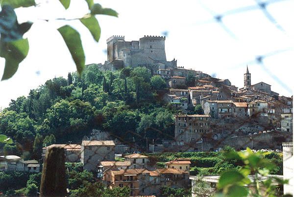
Civita Castellana is a town and comune in the province of Viterbo, 65 kilometres (40 mi) north of Rome.
Contents
Map of Civita Castellana, Province of Viterbo, Italy
Mount Soracte lies about 10 kilometres (6 mi) to the south-east.
History
Civita Castellana was settled during the Iron Age by the Italic people of the Falisci, who called it Falerii. After the Faliscan defeat against the Romans, a new city was built by the latter, about 5 kilometres (3 mi) away, and called Falerii Novi.
The abandoned city was repopulated beginning in the early Middle Ages, with the new name of Civita Castellana (roughly translated as "City of the Castle") mentioned first in 994. In the following centuries the city was a flourishing independent commune, often contended by the Pope and the Holy Roman Empire. Captured by Pope Paschal II at the beginning of the 12th century, the city was given as fief to the Savelli by Gregory XIV.
Sixtus IV assigned the city to Cardinal Rodrigo Borgia, the future Pope Alexander VI, who started the construction of the Rocca ("Castle"), which was completed under Julius II.
Civita Castellana became an important road hub with the connection to the Via Flaminia (1606) and the construction of Ponte Clementino after the French victory against a Neapolitan army in 1709.
Main sights
The town also contains the ruins of the Castle of Paterno, where, on 23 January 1002, Emperor Otto III died at the age of 22.
The National Museum of the Faliscan Countryside contains findings from the ancient Falerii and the surrounding areas.