
Population 209,847 (2015) (16th) Mayor Henry Barlow Website City of Wyndham Founded 1862 Federal division Division of Lalor | Established 1862 County Bourke, Grant Area 541.6 km² Council seat Werribee Team Point Cook Football Club | |
 | ||
State electorate(s) Altona
Tarneit
Werribee Points of interest Werribee Open Range Zoo, Werribee Park, Point Cook Coastal Park, Werribee Gorge State Park, Victoria State Rose Garden | ||
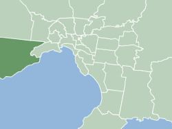
The City of Wyndham is a local government area in Victoria, Australia in the outer south-western suburbs of Melbourne, within the Melbourne Metropolitan Area, between Melbourne and the regional city of Geelong. It has an area of 542 square kilometres (209 sq mi). The official population of Wyndham at 30 June 2014 was 199,715.
Contents
Map of Wyndham, VIC, Australia
History
The Wyndham District was first incorporated as a local government entity on 6 October 1862. Under changes made to Local Government legislation, it became the Shire of Wyndham on 7 March 1864 and was renamed the Shire of Werribee on 15 December 1909.
With an initial size of 715 square kilometres (276 sq mi) and being largely rural in character, the shire ceded land to metropolitan Melbourne as suburban development encroached. On 6 January 1922 and 5 February 1941, the City of Footscray annexed two parcels of land totalling about 700 hectares. On 20 February 1957, the Altona Riding of the Shire of Werribee was severed and incorporated as the Shire of Altona, which became a City eleven years later. After this, the boundaries remained fairly stable, and on 20 March 1987 Werribee was proclaimed a City.
On 15 December 1994, during major restructuring of Victoria's local governments, Werribee changed less than most – losing only some rural land around Exford in its north to the Shire of Melton, and Laverton Reserve on its eastern boundary to the City of Hobsons Bay. After 85 years of being known as Werribee, the area's former name of Wyndham was restored.
Population
The City is home to numerous new housing estates in suburbs such as Williams Landing, Point Cook, Wyndham Vale, Truganina and Tarneit. The following table presents data from official census and other publications by the Australian Bureau of Statistics:
* Estimates in 1958, 1983 and 1988 Victorian Year Books.
# Excludes Altona Shire which was severed in 1957. Source: 1958 Victorian Year Book.
^ Based on 2011 Census data.
Wards and councillors
The City of Wyndham is divided into three wards (Chaffey, Harrison and Iramoo) and is represented by eleven elected councillors. The Victorian Electoral Commission undertook a representation review in 2011–2012, which resulted in the former Truganina ward being renamed Harrison ward. Ward boundaries were also redrawn. The council has adopted a portfolio system for councillors from 2013 onward.
Victorian Local Government elections were held on Saturday 22 October 2016 and the following were elected as councillors: