
Population 204,442 (2015) (20th) Time zone AEST (UTC+10) Region Metropolitan Sydney | Area 102 km (39.4 sq mi) Council seat Wakeley | |
 | ||
Mayor Frank Carbone ([Independent]) | ||
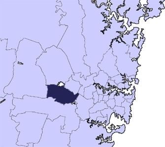
The City of Fairfield is a local government area in the south-west of Sydney, in the state of New South Wales, Australia. The City of Fairfield is 102 square kilometres (39 sq mi).
Contents
- Suburbs in the local government area
- Demographics
- Current composition and election method
- History
- Land use
- Environment
- Schools
- Culture
- Sister cities
- References
A few small areas of the original bushland remain, including examples of Cumberland Plain vegetation, which is listed under the Threatened Species Conservation Act. There are 580 parks (60 of which are major parks), including, one of the largest urban parks in the world, Western Sydney Parklands. Fairfield City is mainly residential in nature with large-scale industrial estates at Wetherill Park and Smithfield.
Fairfield is considered one of the most ethnically diverse suburbs in Australia. At the 2011 Census, the proportion of residents in the Fairfield local government area who stated their ancestry as Vietnamese and Assyrian, was in excess of sixteen times the national average. The area was linguistically diverse, with Vietnamese, Arabic, Assyrian Neo-Aramaic, or Cantonese languages spoken in households, and ranged from two times to seventeen times the national averages. The Mayor of the City of Fairfield is Cr. Frank Carbone, first Independent Mayor in Fairfield.
Suburbs in the local government area
Suburbs in the City of Fairfield are:
Demographics
At the 2011 Census, there were 187,766 people in the Fairfield local government area, of these 49.3% were male and 50.7% were female. Aboriginal and Torres Strait Islander people made up 0.7% of the population. The median age of people in the City of Fairfield was 36 years. Children aged 0 – 14 years made up 20.4% of the population and people aged 65 years and over made up 12.0% of the population. Of people in the area aged 15 years and over, 49.6% were married and 11.6% were either divorced or separated.
Population in the City of Fairfield between the 2001 Census and the 2006 Census declined by 0.78%; and in the subsequent five years to the 2011 Census, population growth was 4.38%. When compared with total population growth of Australia for the same periods, being 5.78% and 8.32% respectively, population growth in Fairfield local government area was over half the national average. The median weekly income for residents within the City of Fairfield was lower than the national average, being one of the factors that place the City in an area of social disadvantage.
The proportion of residents who stated a religious affiliation with Buddhism was in excess of nine times the national average; and the proportion of residents with no religion about half the national average.
Current composition and election method
Fairfield City Council is composed of thirteen Councillors, including the Mayor, for a fixed four-year term of office. The Mayor is directly elected while the twelve other Councillors are elected proportionally as three separate wards, each electing four Councillors. The most recent election was held on 10 September 2016, and the makeup of the Council, including the Mayor, is as follows:
The current Council, elected in 2016, in order of election by ward, is:
History
For more than 30,000 years, Aboriginal people from the Cabrogal-Gandangara tribe have lived in the area.
European settlement began early in the 19th century and was supported by railway construction in 1856. At the turn of the century the area had a population of 2,500 people and with fertile soils, produced crops for distribution in Sydney.
Rapid population increase after World War II saw the settlement of many ex-service men and European migrants. Large scale Housing Commission development in the 1950s swelled the population to 38,000. By 1979, the population had reached 120,000 and the City was becoming one of the larger local government areas in New South Wales.
On 4 September 2006, Fairfield Council announced that it had banned spitting in public, which is now punishable with a fine of up to $1100. This is the only ruling of its kind in New South Wales. This also applies to people who spit their chewing gum onto the floor.
Land use
There are a number of planning instruments, metropolitan and local strategies that govern the role and function of the Fairfield City centres network and that are relevant towards the future direction and nature of future growth within the Fairfield Town Centre: Fairfield Local Environmental Plan 2013, A Plan for Growing Sydney (2014), Fairfield Residential Study 2009, and Fairfield City Centres Study and Policy (2015).
A Plan for Growing Sydney (2014) identifies the development of Parramatta as a second CBD for Sydney, with Penrith, Campbelltown – Macarthur and Liverpool identified as Regional City Centres within the western corridor. The Plan also identifies a number of Strategic Centres throughout Greater Sydney, which are priority locations for employment, retail, housing, services and mixed-uses. Strategic Centres are currently or are planned to have at least 10,000 jobs. Leppington, Bankstown and Blacktown represent the closest Strategic Centres to Fairfield.
There are four town centres at Fairfield (traditional heart of the City with two shopping malls), Cabramatta (unique suburban centre with thriving South East Asian business, retail, food and restaurants), Bonnyrigg (smaller suburban shopping mall and a centre in transition with high density housing being developed) and Prairiewood (large suburban shopping mall forming the heart of the Western part of the City). Fairfield City Centre was estimated to provide the largest amount of jobs at approximately 4,800, followed by Prairiewood (3,000), Cabramatta (2,200) and Bonnyrigg (1,800). However, these job numbers all fall short of the 8,000 minimum that has been suggested for Major Centres.
Fairfield City Centre has two shopping malls with supermarket anchors: Fairfield Forum and Neeta City. Since the early 2000s, lower rise development has given way to a dozen multi-storey residential developments, both completed and approved. Fairfield City Centre was the civic heart of the City until the Council (local government authority) relocated to the geographical centre of the City (Wakeley) in 1982. The Fairfield Police Station, Fairfield Courthouse and the Federal Government's Centrelink and Medicare office remain to serve the immediate region with a population of 200,000.
Fairfield City Centre and Cabramatta are located on a railway line in the east of the City, while Prairiewood and Bonnyrigg are located on the Liverpool to Parramatta bus transit way located within the west of the City. All centres are linked by bus services.
Due to Fairfield's culturally diverse population there are over twenty different multicultural cafés and restaurants including Bosnian, Chinese, Vietnamese, Italian, Assyrian, Spanish and Thai.
Large expanses of rural land characterise the suburbs of Horsley Park and Cecil Park. This rural area will face pressures for transition as the Western Sydney Airport was approved for development by the Federal Government on 12 December 2016. The airport site is in relative close proximity to the rural area.
Environment
Much of the original bushland cover within the City has been cleared through past land management practices. To the west of the City's border lies the Western Sydney Regional Park and a prominent woodland area Wetherill Park Nature Reserve.
Eight creeks, 80 kilometres (50 mi) in length, have their headwaters in Fairfield City and flow into the Georges River and Hawkesbury Nepean catchments. The impact of development over the past 50 years has resulted in severe degradation of the natural habitat in the creek banks and water quality has been assessed as very poor in recent years. Strategies are being implemented so that this trend is being reversed.
Air quality in the City is heavily impacted upon by an insufficiently integrated public transport system, creating an over reliance upon private vehicles for moving people and freight.
Schools
Schools in the City of Fairfield include: Fairfield Public School, Fairfield High School, St Johns Park High School, Westfields Sports High School, Fairvale High School, Yennora Public School, Canley Vale High School and many more. There are also many Catholic Schools such as: Patrician Brothers' College, Our Lady of the Rosary Primary School, Mary Mackillop College, Freeman Catholic College, Sacred Heart School, St Hurmizd's Assyrian primary school and Mar Narsai Assyrian college.
Culture
Fairfield has two major local newspapers, The Fairfield Advance and the Fairfield Champion; both are published every Wednesday.