
Construction 1946-1960 Area 139 ha | Neighbourhood City Park Time zone CST (UTC-6) Population 4,405 (2009) | |
 | ||
Restaurants Ming's Kitchen, Golden Pagoda Burmese, living sky cafe, Noodle King & Ice Cream Q, Black Pepper | ||
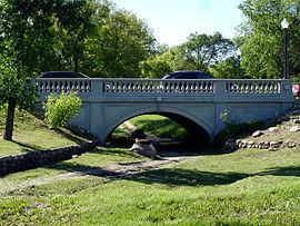
City park saskatoon sk area 3 cam bird jordan bird re max saskatoon
City Park is a mixed-use neighbourhood located near the center of Saskatoon, Saskatchewan, Canada. It comprises a mix of single-family detached homes, apartment buildings and other semi-detached dwellings. It also contains a number of commercial zones with businesses. As of 2009, the area was home to 4,405 residents. The neighbourhood is considered a middle-income area, with an average family income of $42,236, an average dwelling value of $245,254 and a home ownership rate of 28.6%. According to MLS data, the average sale price of a home as of 2013 was $305,157.
Contents
- City park saskatoon sk area 3 cam bird jordan bird re max saskatoon
- Map of City Park Saskatoon SK Canada
- History
- Government and politics
- Education
- Health
- Parks and recreation
- Public services
- Commercial
- Location
- References
Map of City Park, Saskatoon, SK, Canada
History
City Park was originally known as Central Park and first had a golf course. In 1903, the annual exhibition was moved from the Louise Grounds in Nutana to City Park, and a horse racing track and grandstand were constructed. By 1910, the exhibition had moved to its permanent home in the city's south end. The outline of the old racetrack can still be seen in what is now Kinsmen Park.
City Park was one of the first areas annexed by the city after its incorporation in 1906. The Alexander Residence, built in 1912 on Spadina Crescent, was named for Dr. Harold E. and Edith Alexander, who owned the house from 1916 to 1946. It is one of the city's most notable examples of pre-World War I Arts and Crafts architecture. It was designated a municipal heritage property on May 12, 2001.
Government and politics
City Park exists within the federal electoral district of Saskatoon—Wanuskewin. Provincially, the area overlaps two separate constituencies:
In Saskatoon's non-partisan municipal politics, City Park lies within Ward 1.
Education
Health
Parks and recreation
The Mendel Art Gallery is Saskatoon's major public art gallery, containing works of art from local, national and international artists. Attached to the gallery is Saskatoon's civic conservatory, containing seasonal flower displays as well as tropical and arid plants.
The City Park Community Association organizes social and leisure programs, such as adult fitness, children/youth sports and preschool playgrounds. The association also maintains the outdoor rink at the former First Nations University of Canada campus.
Public services
City Park is a part of the central division of the Saskatoon Police Services patrol system. Saskatoon Fire & Protective Services' central division covers the neighbourhood. Transit services to City Park are provided by Saskatoon Transit on routes 12 (River Heights/City Centre) and 14 (North Industrial/City Centre).
Commercial
City Park contains several business districts. On the west side and south sides of the neighbourhood are commercial zones immediately adjacent to the Central Business District. Several professional businesses line Queen Street, which runs past Saskatoon City Hospital. There is a small collection of businesses near the center of City Park, at 7th Avenue North and Princess Street. Finally, there are businesses along the north edge of the neighbourhood, parallel to the Canadian Pacific Railway tracks. There are 66 home-based businesses in City Park.
Location
City Park is located within the Core Neighbourhoods Suburban Development Area. It is bounded by the South Saskatchewan River to the east, railway tracks to the west, 33rd Street to the north, and 25th Street to the south. Most Streets are laid out in a grid plan, with avenues running north-south and streets running east-west. Some roads in the south and west parts of City Park are angled to align with their continuations in the Central Business District. Spadina Crescent roughly follows the course of the river on the east edge of the neighbourhood.