
Classification Family A (high-level) Minimum altitude (feet) 20,000 | Abbreviation Cc | |
 | ||
Genus Cirro- (curl of hair)-cumulus (heaped) Precipitation cloud? Occasionally virga. May form ahead of a frontal system, especially together with other cirriform clouds meaning rain in around 10 hours. Appearance Small, high, patched clouds, in rows Indicates precipitation Occasionally virga (evaporates before reaching the ground). May form ahead of a frontal system, especially together with other cirriform clouds meaning rain in around 10 hours | ||
Cirrocumulus is one of the three main genus-types of high-altitude tropospheric clouds, the other two being cirrus and cirrostratus. They usually occur at an altitude of 5 kilometres (16,000 ft) to 12 kilometres (39,000 ft). Like lower altitude cumuliform and stratocumuliform clouds, cirrocumulus signifies convection. Unlike other high cirrus and cirrostratus, cirrocumulus includes a small amount of liquid water droplets, although these are in a supercooled state. Ice crystals are the predominant component, and typically, the ice crystals cause the supercooled water drops in the cloud to rapidly freeze, transforming the cirrocumulus into cirrostratus. This process can also produce precipitation in the form of a virga consisting of ice or snow. Thus cirrocumulus clouds are usually short-lived. They usually only form as part of a short-lived transitional phase within an area of cirrus clouds and can also form briefly as a result of the breaking up of part of a cumulonimbus anvil.
Contents

Properly, the term cirrocumulus refers to each cloud, but is typically also used to refer to an entire patch of cirrocumulus. When used in this way, each cirrocumulus element is referred to as a "cloudlet".
Appearance
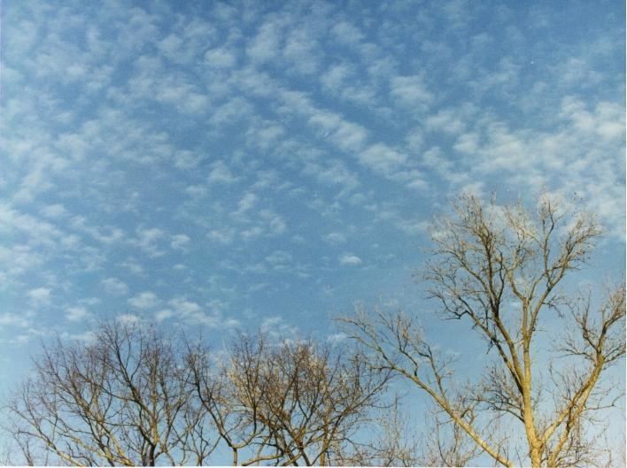
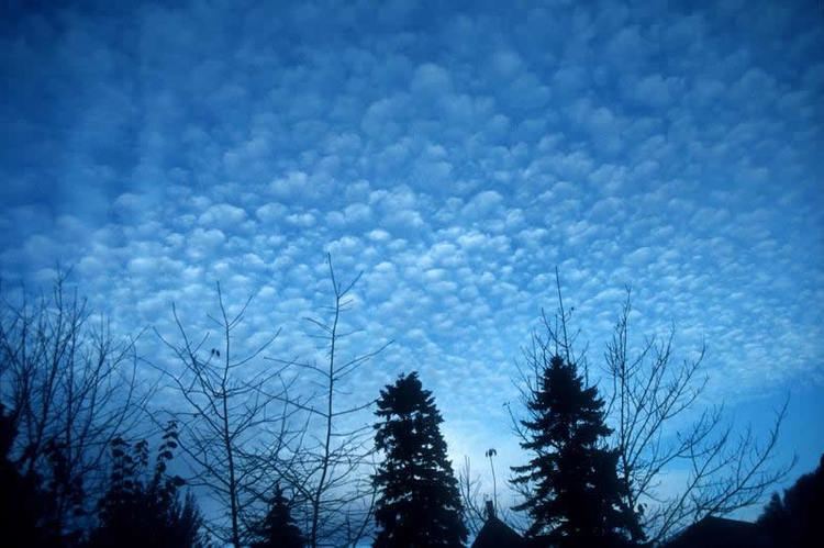
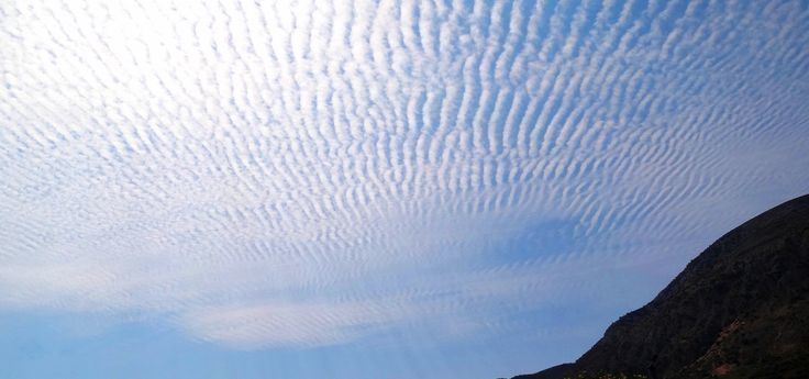
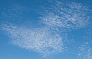
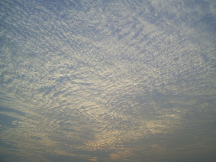
Cirrocumulus is a cloud of the stratocumuliform physical category that shows both stratiform and cumuliform characteristics and typically appears as white, patchy sheets with ripples or tufts without gray shading. Each cloudlet appears no larger than a finger held at arm's length. These often are organized in rows like other cumuliform and stratocumuliform clouds, but since they are so small, cirrocumulus patches take on a finer appearance, sometimes also referred to colloquially as "herringbone" or as a "mackerel sky". Cirrocumulus is coded CH9 for the main genus-type and all subforms.
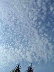
Cirrocumulus is distinguished from altocumulus in several ways, although the two stratocumuliform genus types can occasionally occur together with no clear demarcation between them. Cirrocumulus generally occur at higher altitudes than altocumulus, and thus the "cloudlets" appear smaller as they are more distant from observation at ground level. They are also colder. Cirrocumulus clouds never cast self-shadows and are translucent to a certain degree. They are also typically found amongst other cirrus clouds in the sky, and are usually themselves seen to be transforming into these other types of cirrus. This often occurs at the leading edge of a warm front, where many types of cirriform clouds can be present.
Cirrocumulus clouds tend to reflect the red and yellow colours during a sunset and sunrise, and thus they have been referred to as "one of the most beautiful clouds". This occurs because they reflect the unscattered rays of light from the early morning or evening sun, and those rays are yellow, orange, red, and sometimes purple
Forecasting
Cirrocumulus usually only forms in patches. If it forms in patches with cirrus or cirrostratus and the clouds spread across the sky, it usually means rain in 8–10 hours (can be more if front is slow moving). If there are only small patches of cirrocumulus and perhaps some wisps of cirrus, it usually means a continuation of good weather (although this may also be seen in conjunction with showers and thunderstorms). If it is seen after rain it usually means improving weather.