
Municipality Cimanes de la Vega Time zone CET (UTC+1) Elevation 720 m Local time Saturday 8:18 PM | Demonym(s) cimanés, cimanesa Postal Code 24239 Area 26.04 km² Population 497 (2014) Area code 987 | |
 | ||
Weather 6°C, Wind SW at 14 km/h, 58% Humidity | ||
Romeria virgen de la vega desde benavente a cimanes de la vega
Cimanes de la Vega ([θiˈmanez ðe la ˈβeɣa]) is the most southerly municipality in the province of León, northern Spain. Located along the N-620 highway (León - Benavente), it is close to the Esla River.
Contents
- Romeria virgen de la vega desde benavente a cimanes de la vega
- Map of 24239 Cimanes de la Vega LeC3B3n Spain
- References
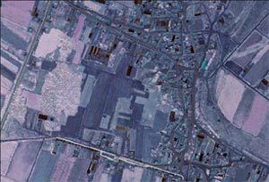
Map of 24239 Cimanes de la Vega, Le%C3%B3n, Spain
It has around 570 inhabitants, grouped in three villages: Cimanes de la Vega, Bariones de la Vega and Lordemanos de la Vega. Agriculture is the main activity. Irrigation is important as the land is dry. The main crops are beet (Beta vulgaris), maize (Zea mays) and cattle fodder.
Sights include the "Virgen de la Vega", an 11th-century hermitage.
References
Cimanes de la Vega Wikipedia(Text) CC BY-SA