Founded June 19, 1981 Website www.co.cibola.nm.us Population 27,335 (2013) | Area 11,764 km² | |
 | ||
Points of interest El Morro National Monument, Sky City Cultural Center/H, Ice Caves, Dancing Eagle Casino, Wild Spirit Wolf Sanctuary Destinations Acoma Pueblo, Grants, Continental Divide Trail, El Malpais National Monument, Bluewater Lake State Park | ||
12 wooded acres in cibola county new mexico at wholesale price
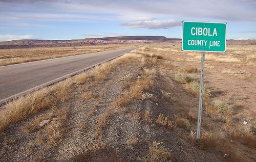
Cibola County is a county in the U.S. state of New Mexico. As of the 2010 census, the population was 27,213. Its county seat is Grants. It is New Mexico's youngest county, created on June 19, 1981, from the westernmost four-fifths of the formerly much larger Valencia County.
Contents
- 12 wooded acres in cibola county new mexico at wholesale price
- Map of Cibola County NM USA
- Geography
- Adjacent counties
- National protected areas
- 2000 census
- 2010 census
- Education
- Corrections
- City
- Town
- References
Map of Cibola County, NM, USA
Cibola County comprises the Grants, NM Micropolitan Statistical Area, which is also part of the Albuquerque-Santa Fe-Las Vegas, NM Combined Statistical Area.
Geography
According to the U.S. Census Bureau, the county has an area of 4,542 square miles (11,760 km2), of which 4,539 square miles (11,760 km2) is land and 2.3 square miles (6.0 km2) (0.05%) is water.
Adjacent counties
National protected areas
2000 census
As of the census of 2000, there were 25,595 people, 8,327 households, and 6,278 families residing in the county. The population density was 6 people per square mile (2/km²). There were 10,328 housing units at an average density of 2 per square mile (1/km²). The racial makeup of the county was 39.61% White, 0.96% Black or African American, 40.32% Native American, 0.38% Asian, 0.05% Pacific Islander, 15.44% from other races, and 3.24% from two or more races. 33.42% of the population were Hispanic or Latino of any race.
There were 8,327 households out of which 38.00% had children under the age of 18 living with them, 50.60% were married couples living together, 18.30% had a female householder with no husband present, and 24.60% were non-families. 21.10% of all households were made up of individuals and 7.30% had someone living alone who was 65 years of age or older. The average household size was 2.95 and the average family size was 3.41.
In the county, the population was spread out with 30.70% under the age of 18, 9.60% from 18 to 24, 27.50% from 25 to 44, 21.50% from 45 to 64, and 10.70% who were 65 years of age or older. The median age was 33 years. For every 100 females there were 95.50 males. For every 100 females age 18 and over, there were 92.20 males.
The median income for a household in the county was $27,774, and the median income for a family was $30,714. Males had a median income of $27,652 versus $20,078 for females. The per capita income for the county was $11,731. About 21.50% of families and 24.80% of the population were below the poverty line, including 32.00% of those under age 18 and 17.70% of those age 65 or over.
2010 census
As of the 2010 United States Census, there were 27,213 people, 8,860 households, and 6,274 families residing in the county. The population density was 6.0 inhabitants per square mile (2.3/km2). There were 11,101 housing units at an average density of 2.4 per square mile (0.93/km2). The racial makeup of the county was 41.8% white, 41.0% American Indian, 1.0% black or African American, 0.5% Asian, 0.1% Pacific islander, 12.4% from other races, and 3.1% from two or more races. Those of Hispanic or Latino origin made up 36.5% of the population. In terms of ancestry, 5.4% were Irish, and 1.5% were American.
Of the 8,860 households, 38.0% had children under the age of 18 living with them, 41.1% were married couples living together, 20.8% had a female householder with no husband present, 29.2% were non-families, and 24.9% of all households were made up of individuals. The average household size was 2.79 and the average family size was 3.30. The median age was 36.6 years.
The median income for a household in the county was $37,361 and the median income for a family was $41,187. Males had a median income of $36,027 versus $25,318 for females. The per capita income for the county was $14,712. About 20.1% of families and 24.0% of the population were below the poverty line, including 32.7% of those under age 18 and 14.3% of those age 65 or over.
Education
All public schools in the county are operated by Grants/Cibola County Schools.
Corrections
Cibola County is home to three prisons:
