
Website www.catroncounty.us Founded 25 February 1921 Population 3,607 (2013) | Area 17,946 km² | |
 | ||
Points of interest Gila Cliff Dwellings National, Karl G Jansky Very Larg, The Lightning Field, Catwalk Recreation Area, Snow Lake | ||
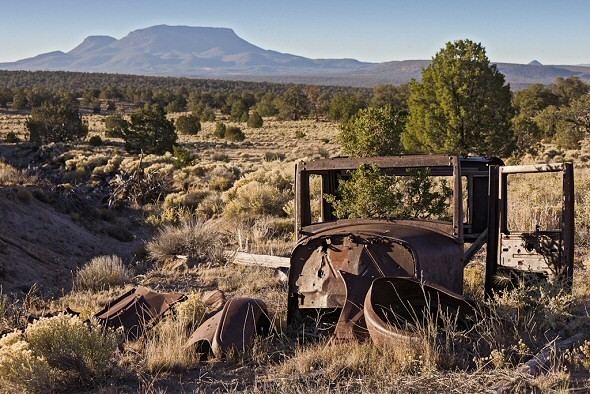
How an 82 year old korean war veteran keeps catron county new mexico safe from its highest peak
Catron County is a county in the U.S. state of New Mexico. As of the 2010 census, the population was 3,725, making it New Mexico's third-least populous county. Its county seat is Reserve. Catron County is New Mexico's largest county by area.
Contents
- How an 82 year old korean war veteran keeps catron county new mexico safe from its highest peak
- Map of Catron County NM USA
- The lightning field catron county new mexico best travel destination
- History
- Geography
- Forests
- Adjacent counties
- National protected areas
- 2000 census
- 2010 census
- Points of interest
- Village
- Unincorporated communities
- Notable people
- References
Map of Catron County, NM, USA
The lightning field catron county new mexico best travel destination
History
Settlement in the Catron County region dates to some of the earliest in the Americas. During the Clovis period between 10999 BC and 8000 BC and Folsom period between 7999 BC and 5999 BC, the Ake Site was occupied near Datil. Bat Cave, near Horse Springs, was occupied around 3,500 BC.
The Mimbres culture was part of the Mogollon people who lived throughout the Catron County area from AD 1000 to 1130. Their art is renowned for its beauty.
In 1598, the region was declared part of Santa Fé de Nuevo México, a province in New Spain. The province remained in Spanish control until Mexico's declaration of independence in 1821. Under the 1824 Constitution of Mexico, this became the federally administered Territory of New Mexico. European settlement of this region started with the Spanish. It intensified after the US acquired New Mexico as a result of the Mexican-American War. More settlers moved to the state after it was admitted to the Union in 1912. was admitted to the union in 1912. United States.
Mexico ceded the region to the U.S. in the Treaty of Guadalupe Hidalgo in 1848 after the Mexican-American War. In 1849, President Zachary Taylor proposed that New Mexico, including this region, immediately become a state to sidestep political conflict over slavery in the territories. That did not happen.
In 1880, Sergeant James C. Cooney was the first person to find silver and gold ore in the mountains of Catron County. He was reportedly killed by Chiricahua Apaches led by Victorio that year in what became known as the "Alma Massacre". His remains are buried at Cooney's Tomb. During this time Cochise was active as another well-known Chiricahua leader. Noted war chief Goyaałé (Geronimo) had several hideouts in the county. Later in 1880, Buffalo Soldiers led by Sergeant George Jordan defeated Chiricahua Apache warriors led by Victorio in the Battle of Fort Tularosa. Four years later, self-appointed sheriff Elfego Baca was the hero of the so-called Frisco Shootout in San Francisco Plaza.
In the mid-1880s Butch Cassidy and his Wild Bunch gang holed up at a ranch near Alma, New Mexico. Notorious outlaw Tom Ketchum also lived in Catron County around this time.
Catron County's lands were part of Socorro County from the creation of Santa Fé de Nuevo México until 1921. At that split, Catron county was named for Thomas B. Catron, a leading figure in New Mexico statehood and its first senator. In 1927, the State Legislature attempted to abolish both Socorro and Catron in order to create a new Rio Grande County. A court suit voided this act and the two counties retained their independence.
The Lightning Field, an art installation on the open earth, brought national attention to Quemado in the late 1970s.
Geography
According to the U.S. Census Bureau, the county has a total area of 6,929 square miles (17,950 km2), of which 6,924 square miles (17,930 km2) is land and 5.5 square miles (14 km2) (0.08%) is water.
Catron County is the largest county, by area, in New Mexico. At almost 7,000 square miles (18,000 km2), Catron County is larger than four states. With a population of only 3,400 people, the county is as sparsely populated as many an old West frontier area. The elk population at some 12,000 head, makes up for the sparse people population.
Within the boundaries of Catron County lie parts of the Gila National Forest, the Apache National Forest and the Cibola National Forest. The establishment of these national forests, in the past called "forest reserves," led to the name Reserve being given to a village on the San Francisco River, which also serves as the County Seat. There are no stop lights in the whole county, so when license tests are given in Reserve, an artificial portable stop light is set up in a parking lot.
Bordering Arizona, Catron County affords the shortest route between Albuquerque and Phoenix or Tucson. Reserve can also be reached by following U.S. Route 180 north from Silver City and New Mexico State Road 12 east for a total of 99 miles (159 km).
In Catron County there is a volcanic area that until recently contained sufficient heat to cause steam to rise after a slight rain. It is called Burning Mountain and appears to have been used by the Apache for healing purposes. The county is home to the Red Hill Volcanic Field as well as the Plains of San Agustin.
Forests
Adjacent counties
National protected areas
2000 census
As of the census of 2000, there were 3,543 people, 1,584 households, and 1,040 families residing in the county. The population density was 0.51 people per square mile (0.20/km²). There were 2,548 housing units at an average density of 0.37 per square mile (0.14/km²). The racial makeup of the county was 87.75% White, 0.28% Black or African American, 2.20% Native American, 0.68% Asian, 0.06% Pacific Islander, 5.42% from other races, and 3.61% from two or more races. 19.16% of the population were Hispanic or Latino of any race.
There were 1,584 households out of which 22.30% had children under the age of 18 living with them, 55.40% were married couples living together, 7.60% had a female householder with no husband present, and 34.30% were non-families. 30.10% of all households were made up of individuals and 11.40% had someone living alone who was 65 years of age or older. The average household size was 2.23 and the average family size was 2.75.
In the county, the population was spread out with 21.10% under the age of 18, 4.20% from 18 to 24, 19.50% from 25 to 44, 36.40% from 45 to 64, and 18.80% who were 65 years of age or older. The median age was 48 years. For every 100 females there were 104.70 males. For every 100 females age 18 and over, there were 101.70 males.
The median income for a household in the county was $23,892, and the median income for a family was $30,742. Males had a median income of $26,064 versus $18,315 for females. The per capita income for the county was $13,951. About 17.40% of families and 24.50% of the population were below the poverty line, including 39.60% of those under age 18 and 14.90% of those age 65 or over.
2010 census
As of the 2010 United States Census, there were 3,725 people, 1,787 households, and 1,080 families residing in the county. The population density was 0.5 inhabitants per square mile (0.19/km2). There were 3,289 housing units at an average density of 0.5 per square mile (0.19/km2). The racial makeup of the county was 89.8% white, 2.7% American Indian, 0.4% black or African American, 0.2% Asian, 3.8% from other races, and 3.1% from two or more races. Those of Hispanic or Latino origin made up 19.0% of the population. In terms of ancestry, 29.1% were American, 18.8% were English, 17.5% were German, and 9.8% were Irish.
Of the 1,787 households, 16.4% had children under the age of 18 living with them, 52.2% were married couples living together, 4.8% had a female householder with no husband present, 39.6% were non-families, and 34.8% of all households were made up of individuals. The average household size was 2.03 and the average family size was 2.57. The median age was 55.8 years.
The median income for a household in the county was $31,914 and the median income for a family was $40,906. Males had a median income of $46,304 versus $23,325 for females. The per capita income for the county was $20,895. About 10.1% of families and 15.3% of the population were below the poverty line, including 31.5% of those under age 18 and 12.0% of those age 65 or over.