
- elevation 0 ft (0 m) Basin area 2,600 km² | - location Algonquin, Maryland Length 114 km Basin area 2,600 km² | |
 | ||
Raw video boaters brawl on choptank river in maryland
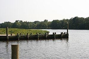
The Choptank River is a major tributary of the Chesapeake Bay and the largest river on the Delmarva Peninsula. Running for 71 miles (114 km), it rises in Kent County, Delaware, runs through Caroline County, Maryland and forms much of the border between Talbot County, Maryland on the north, and Caroline County and Dorchester County on the east and south. It is located north of the Nanticoke River and its mouth is located south of Eastern Bay. Cambridge, the county seat of Dorchester County, and Denton, the county seat of Caroline County, are located on its south shore.
Contents
- Raw video boaters brawl on choptank river in maryland
- Map of Choptank River 8 Neck MD USA
- Michael butler choptank river boys
- CourseEdit
- NavigabilityEdit
- TributariesEdit
- References
Map of Choptank River, 8, Neck, MD, USA
Its watershed area in Maryland is 1,004 square miles (2,600 km2), of which 224 square miles (580 km2) is open water, so it is 22% water. The predominant land use is agricultural with 418 square miles (1,080 km2), or 48% of the land area.
The $155 million Hyatt Regency Chesapeake Bay Golf Resort, Spa & Marina is situated on the east shore in Cambridge, MD. Completed in 2002, the resort is the only of its kind in the Mid-Atlantic United States. However, Hyatt has been struggling to make bond payments on the property.
Michael butler choptank river boys
CourseEdit
The Choptank River begins at Choptank Mills, Delaware, where Tidy Island Creek and Culbreth Marsh Ditch join together. It ends at the Chesapeake Bay in a very wide mouth between Blackwalnut Point on Tilghman Island, and Cook Point, near Hudson, Maryland. Tidy Island Creek and Culbreth Marsh Ditch rise in western Kent County, Delaware. The entire watershed is in the coastal plain. The Choptank reaches sea level near Denton, Maryland and is not salty until around 2 miles (3.2 km) below Denton. Greensboro, Maryland, about 6 miles (9.7 km) up the river from Denton, is the head of navigation.
NavigabilityEdit
The river is navigable up to Denton, about 45 miles upriver. The bridge at Cambridge limits traffic to 50 feet vertical clearance. The river’s mouth is marked in the main channel by an abandoned, tilting masonry lighthouse on the now-extinct Sharps’ Island. Knapp’s Narrows offers a shortcut to boats approaching from the north.
TributariesEdit
Its main tributaries are the Tred Avon River and Tuckahoe Creek on the north side and Cabin Creek and Hunting Creek on the south side.
There are several small creeks on the northern shore, including Harris Creek, Broad Creek, Irish Creek, Island Creek, La Trappe Creek, Bolingroke Creek, Mile Creek, Kings Creek, Forge Branch and Broadway Branch. On the southern shore the small creeks include Jenkins Creek, the Warwick River, Marsh Creek, Maryland, Skeleton Creek, Mitchell Run, Hog Creek, Fowling Creek, Robins Creek, Church Creek, Williston Creek, Watts Creek, Chapel Branch, Spring Branch, Gravelly Branch and Cow Marsh Creek.