
- elevation 439 ft (134 m) Length 4 km | - elevation 377 ft (115 m) | |
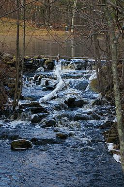 | ||
The Chockalog River is a river in the U.S. states of Massachusetts and Rhode Island. It flows approximately 4 km (2 mi). Its name is said to mean "fox place".
Contents
Map of Chockalog River, United States
CourseEdit
The river is formed in Douglas, Massachusetts by the confluence of Greene and Cedar Swamp brooks. From there, it flows south to Burrillville, Rhode Island where it converges with Round Top Brook to form the Nipmuc River.
CrossingsEdit
Brook Road in Burrillville is the only crossing over the Chockalog River due to its short length.
TributariesEdit
The Chockalog River has no named tributaries, though it has many unnamed streams that also feed it.
References
Chockalog River Wikipedia(Text) CC BY-SA