
Country Pakistan Established 1970 Number of Tehsils 6 Founded 1970 Province Khyber Pakhtunkhwa | Capital Chitral Time zone PST (UTC+5) Area 14,850 km² Population 414,000 (2014) | |
 | ||
Website www.khyberpakhtunkhwa.gov.pk Similar Chitral, Swat District, Buner District | ||
Chitral (Urdu: ضلع چترال) is the largest district in the Khyber-Pakhtunkhwa province of Pakistan, covering an area of 14,850 km². It is the northernmost district of Pakistan. It shares a border with Gilgit-Baltistan to the east, with Kunar, Badakshan and Nuristan provinces of Afghanistan to the north and west, and with the Khyber-Pakhtunkhwa districts of Swat and Dir to the south. A narrow strip of Wakhan Corridor separates Chitral from Tajikistan in the north.
Contents
- Map of Chitral Pakistan
- History
- Topography and access
- Demographics
- Languages
- Chitral Town
- Administration
- References
Map of Chitral, Pakistan
History
Chitral shares much of its history and culture with the neighboring Hindu-Kush territories of Gilgit-Baltistan, a region sometimes called "Peristan" because of the common belief in fairies (peri) inhabiting the high mountains.
The entire region that now forms the Chitral District was an independent monarchical state until 1895, when the British negotiated a treaty with its hereditary ruler, the Mehtar, under which Chitral became a semi-autonomous princely state within the Indian Empire. Chitral retained this status even after its accession to Pakistan in 1947, only being made an administrative district of Pakistan in 1969.
Topography and access
Chitral is counted amongst the highest regions of the world, sweeping from 1,094 meters at Arandu to 7,726 meters at Tirichmir, and packing over 40 peaks more than 6,100 meters in height. The terrain of Chitral is very mountainous and Tirich Mir (25,289 feet) the highest peak of the Hindu Kush, rises in the north of the district. Around 4.8 per cent of the land is covered by forest and 76 per cent is mountains and glaciers.
Chitral is connected to the rest of Pakistan by two major road routes, the Lowari Pass (el. 10,230 ft.) from Dir and Shandur Top (elevation 12,200 ft.) from Gilgit. Both routes are closed in winter. The Lowari Tunnel is being constructed under the Lowari Pass. A number of other high passes, including Darkot Pass, Thoi Pass and Zagaran Pass, provide access on foot to Chitral from Gilgit-Baltistan in Ghizer District.
Demographics
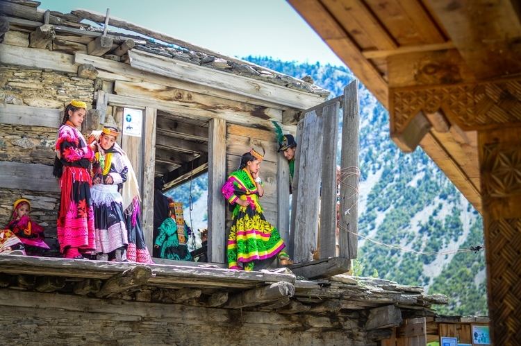
The district has a population of about 414,000. The general population is mainly of the Kho people, who speak the Khowar, which is also spoken in parts of Yasin, Gilgit, Dir and Swat. Chitral is also home to the Kalash tribe, who live in Bumburet and two other remote valleys southwest of Chitral town.
Languages
According to the research of Rehmat Aziz, Director of Kohwari Academy, most of the minority languages are Dardic, including Shina, Kashmiri, Kalasha, Gawar Bati, Dameli, Pashayi, Shina, Kohistani, and Palula.
Iranian languages and Pamir languages spoken by immigrant groups in Chitral include Pushto, Munji, Yidgha, Tajik and Wakhi. The Turkic languages Kyrgyz and Uzbek are also spoken in minority.
Although the predominant language of Chitral is Khowar, more than ten other languages are spoken here. These include Kalasha-mun, Palula, Dameli, Gawar-Bati, Nuristani, Yidgha, Burushaski, Gujar, Wakhi, Uzbeki, Kyrgyz, Dari and Pashto. Since many of these languages have no written form, letters are usually written in Urdu or Pashto.
Chitral Town
The town of Chitral is the main town in the district and serves as its capital. It is situated on the west bank of the Chitral River (also known as the Kunar River) at the foot of Tirich Mir which at 7,708 m (25,289 ft) is the highest peak of the Hindu Kush. Until 1969, it served as the capital of the princely state of Chitral.
Administration
The district of Chitral is divided into twenty-four union councils and two tehsils:
The district elects by direct popular vote, one member of the National Assembly (MNA) and two members of the Provincial Assembly.