
Country India District Chitrakoot PIN 210205 Population 48,853 (2001) Local time Sunday 10:53 PM | Time zone IST (UTC+5:30) Telephone code 05198 Area code 05198 | |
 | ||
Weather 17°C, Wind W at 3 km/h, 38% Humidity Neighborhoods Utaar Khana, Baldauganj, SDM Colony, Bhauri | ||
Chitrakoot abode of the gods
Chitrakoot Dham (Karwi) is district headquarters and a municipal board in Chitrakoot district in the state of Uttar Pradesh, India.
Contents
- Chitrakoot abode of the gods
- Map of Chitrakoot Dham Uttar Pradesh 210205
- History
- Geography
- Demographics
- Education
- Transportation
- Tourist spots
- References
Map of Chitrakoot Dham, Uttar Pradesh 210205
History
In past, Karwi city was a tehsil in Banda district. On 6 May 1997 Government of Uttar Pradesh carved out a new district Chitrakoot (Initially named as Chhatrapati Shahuji Mahraj- Nagar) from Banda district. Since then the city is serving as district headquarters.
The town of Kirwee in New Zealand's Canterbury region was named after Karwi by a retired British Army colonel.
Geography
The city's coordinates are 25° North and 81° East. It is bounded in the north by Kaushambi, in the south by Satna(M.P.) & Rewa (M.P.), in the east by Allahabad (Prayag), in the west by Banda. Chitrakoot Dham (Karwi) is situated on the bank of River Mandakini.
Demographics
As of 2001 India census, Chitrakoot Dham (Karwi) had a population of 48,853. Males constitute 54% of the population and females 46%. Chitrakoot Dham (Karwi) has an average literacy rate of 67%, higher than the national average of 59.5%; with male literacy of 75% and female literacy of 58%. 16% of the population is under 6 years of age.
Education
Higher Education
Schools
Transportation
Road: Chitrakoot Dham (Karwi) falls on National Highway 76 (NH 76) stretched from Pindwara to Allahabad via Udaipur, Chittaurgarh, Kota, Shivpuri, Jhansi and Banda. City is also linked with roadways to all adjoining districts of Banda, Allahabad, Satna, Rewa and Kaushambi. National highways are really in bad condition.
Railways: Chitakoot Dham (Karwi) is an railway station ( IRCTC code: CKTD) on Manikpur - Jhansi/Kanpur main line, served by the North-Central division of Indian Railways. Karwi is connected by trains to Delhi, Mumbai, Kolkata, Bhopal, Raipur, Jabalpur, Kanpur, Khajuraho, Lucknow, Durg and Varanasi.
Air: Allahabad is the nearest operational airport to the city which is 120 km away. Chitrakoot Dham (Karwi) also have an airstrip at Dewangana.
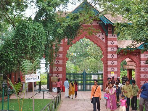
Tourist spots
Ramghat: This is a main ghat in Chitrakoot. Do boating here. you should pay around 100–150 rs for a one-hour personal shikara (Big Boat) booking. Many of them have pet rabbits on the boats and playing with them would be really fun for the kids. Tulsidas status is there on the ghat. Bharat Milap temple is also there on this ghat. you can cover this in around 2 hours. Daily arati happens at 6PM in the evening and you should find some time to secure a place to attend the arati. This is a central place in Chitrakoot and related distance to other main attraction are listed below.
Kamadgiri Parikrama: This is around 5 km parikrama. This can be completed in approx 2 hours. Beware of notorious monkeys on the parikrama, they snatch any polythin from your hand or spectacles. You can put on shoes on the parikrama marg. This place is 1.5 km far from Ramghat.
Hanuman Dhara: This is a hill where there are 3 main spots. Trimukhi Hanuman mandir, Panchmukhi hanuman mandir (Main) and Seeta Rasoi at the top. There is a continuous stream of water that falls on hanuman idol and the source of water is not known. Buy grams of "Chana" and feed langurs here. Langurs are very calm and will hold your hand and eat every chana one by one. This was real fun for the kids. People return after seeing panchmukhi hanuman mandir and do not go to Sita Rasoi. Sita Rasoi is not in good condition and is just an old room where Sitaji cooked food during ram vanvas. frustrating to visit sita rasoi, since there are around 20–25 small temples and every pandit will ask your name and do tilak for your best wishes. There are two ways so take one way to go up and come back using other. This place is around 3 km away from Ramghat.
Gupt Godavari Caves: There are around 3 caves. Water streams flow through these caves. you could see few crabs in the water but don't worry they do not and never harmed pilgrims. In one cave water flows over stones and it is not convenient to walk over such short stones, so be prepared as per your physical fitness/weight. This place is around 20 km from Ramghat.
Sphatic Shila: This is a stone where Lord Ram used to rest. This stone gives a velvet kind of feeling. This place is around 4 km from Ramghat.
Janki Kund: there is a hospital there now and this place is not open to visitors.
Sati Anusuiya Ashram: This is an ashram on the bank of river. This place is around 7 km away from Ramghat, on the way to gupt godavari caves (3 km off route).