
Zone West Hararghe Climate Aw Population 56,900 (2014) | Region Oromia Time zone EAT (UTC+3) Elevation 1,826 m Local time Sunday 7:03 PM | |
 | ||
Weather 23°C, Wind N at 10 km/h, 37% Humidity | ||
Chiro (also called Asebe Teferi or Asba Littoria; Afan Oromo: Ciroo) is a town and separate woreda in eastern Ethiopia. Located in the Amhar Mountains, it has a latitude and longitude of 9°05′N 40°52′E and an altitude of 1826 meters above sea level. It is the administrative center of the West Hararghe Zone.
Contents
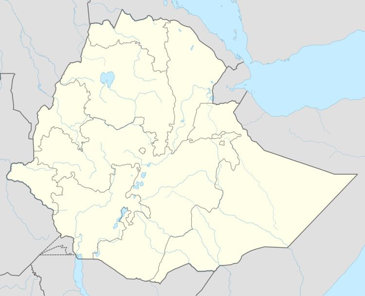
- Map of Asebe Teferi Ethiopia
- Overview
- History
- Foundation and Growth
- Post 1941 Developments
- Demographics
- References
Map of Asebe Teferi, Ethiopia
Overview
Although by the 1930s a road existed which connected the town with the railroad station at Mieso, another road was constructed connecting Chiro with Metehara with Swedish funds in 1966.
History
Chiro was founded around 1924 by Fitawrari Tekle Hawariat Tekle Mariyam on the site of a village named Chiro. It was the capital of the former "model" province of Chercher, created as part of Emperor Haile Selassie's campaign of modernization in the 1930s. Most part of present-day West Hararge zone which was known by its mountainous tract on the rift valley edge was commonly known as cărĉar. It is inhabited by the Itu Oromo. Nole, Ala, Jarso wacalee etc. inhabit different part of the region. The Wacale specifically inhabit Ciro area (Hasan: 1985; informants Wozir). When Menelik’s expansion to the east began to the east, the Ittu land became militarily important because it was considered as a spring board, a sanctuary for the much pressed campaign against the Arsi Oromo. The campaign against Ittu, then, began in 1883 through 1884. The campaign was led by one of Menelik’s general Walda-Gabrel Abba Satan. By 1886 the whole cărĉar came under Wolde Gabriel and he became its governor (Caulk: 1971; Hasan: 1985; Tsehay: 1969). Ever since the period of conquest, the Eastern provinces remained principalities for the Showan royal house. After Harar came under Menelik’s occupation Ras Mekonnen Wolda-Mikael became its governor. Then the whole Hararge became the hereditary fief of the family of Ras Mekonen. This was true to cărĉar. The Showan army that marched to cărĉar went through Gubba-Qoricha, from Baddessa to Galamso and then too Borama. Though Wolde-Gabrel also established garrisons at Galamso the main seat of the neftegna force governing cărĉar was at Qunni where they established Qunni Georgies church (informants 3, 6; Tsehay 1969). Qunni then remained the capital of cărĉar until the foundation of Ciro town (informants 1, 2). During the regence of Tafari Mekonen (later Emperor Haile Sellassie) cash crop and money began to dominate the Ethiopian’s political economy. The previous traditional provincial administration began to give way to money-economy. In Hararge, including cărĉar the a royal families, including Tafari conducted commercial agriculture from which they derived great profit. To realize the development along cash economy, model provinces were set-up. These model provinces were to be controlled by western educated men responsible to the Ministry of Interior in the capital. One such model province was cărĉar, which was governed by Western educated men, first Takle Hawariat Takle-Mariam and later Dr Martin or Azazh Workneh (Greenfield 1969).
Foundation and Growth
Bejrond Takla Hawariat Takla Mariam was assigned as governor of cărĉar in 1923. As soon he became a governor, Takle Hawariat wanted to shift the capital to somewhere else because he did not found Qunni, a site that fulfill a pre request for capital. Located on a mountain massive, Qunni was often very cold and windy. It also suffered from shortage of water and building materials. All these forced Takla Hawariat to shift the capital from Qunni to a more favorable area. First he wanted to establish the capital at Hirna, where he had stayed from about 1912 or 1913. However, he could not get the necessary permission from Ras Tafari. After looking at a number of alternatives he finally decided Ciro to be the center (Bahiru 2002; Hasan 1985; informants 1, 2, 4). In 1923 Takla Hawariat bought plots of land from some land holders and began constructing buildings where to start administrative work. Known figures or notables were then allotted land and house construction continued. This marked the foundation of the town. The news of the foundation soon disseminated and migration to the town began. Another important issue after the foundation of the town is the naming of the town. Takla Hawariat preferred to retain the old local name of the site, Ciro or to name it after a nearby hill, Motti. According to tradition, the area where the town was found was called Ciro, after an indigenous settler named Ciro Sire, from Itu Wucale clan. However, Takla Hawariat was ordered by Ras Tafari Mekonen, to name town as Asebe Teferi. The attempt to use the name Ciro during the Derg remained unsuccessful due to opposition from some who did not like the change. Then, the name Asebe Teferi remained in use until 1991 (Hasan 1985; informants 1, 2, 4).
As mentioned above, migration to the town began as soon as news of its foundation was heard. New settlers came not only from the surrounding areas but also from distant places, all over the country. The town of Ciro was found, built up and developed into one of the best planned town in the country within a short period of time. This is attributed to different factors. First and foremost, compared to the previous capital, Ciro was found on a beautiful setting, heavily forested and green hills on the side of the town. This made the town attractive for life. Moreover, the reforms underwent in the province where Ciro became a center also helped its fast development. Takla Hawariat had begun his reform work while he was conducting his personal farm work at Hirna before the 1920s. Some of the reforms he had carriedout then were the opening of a new caravan route connecting Hirna with Dire Dawa, establishing a new market place and establishing telephone line. He soon started introducing these innovations to Ciro as the town founded. Electricity, water, supply, telecommunication, and postal services were all introduced to Ciro as soon as he became governor. He also divided cărĉar into more rational administrative units in which the province was divided into Tulo, Doba, Qunni, Ya’a-Bishani, Harawacha, Boke, Gubba-Qoricha, Balbaletie, Adal and Ciro. This administrative division also imparted the development of the town as large number of people began to frequent it. A number reforms including land holding system which encouraged producers were also introduced in cărĉar during the administrative tenure of Takla Hawarit between 1923-1930 (Bahiru 2000; informants 1, 2, 4). In 1928 the road that linked Ciro with the railway at Mi’esso very well served the whole province, connected with Dire Dawa-Harar road. The assignment in 1930, of another Western educated figure, Hakim Worqineh Eshete, as governor of cărĉar might have contributed to the development of Ciro town. According to some sources, Worqineh is remembered for introducing a number of services in Ciro town. These include the opening of school, building internal roads and roads to neighboring province. The pioneer primary school in Ciro was opened in 1931, in which the former student of Worqineh, Emmanuel Abraham was one of pioneer teacher and a director.
In addition to the regular school subject the school involved the students in carpentry, sport competitions and other activities. This attracted a number of young children to Ciro (Bahiru 2000; Emmanuel: 1995). This school laid a foundation for later expansion of education (informants 1, 2, 3, 4). According to our informants, a hospital was opened during this period. According up 1930s, government establishments including the palace and offices, the school and private residence houses were in existence. As the result of increased settlement different quarters had also emerged by the 1930s. These include Itu-Safar, Mehal-Safar, Qollegna Safar, Gimjabet safar, Sigabet-Safar, Qes-Amba etc. Qes Amba Safar emerged as the result of the establishment in 1923, of the Church of Egziaber Ab built on a hill overlooking the town of Ciro other neighborhoods including sheek Harar, Ganda Basha, Ganda Lele and Ganda Kolo had already emerged (informants 1, 3, 4). During occupation (1936-1941) the Italians made their center at Arba-Rakkate, a few km away from Chiro town. However, they introduced some innovations for their own purpose which was a contribution for the town. This includes constructing some houses and roads. The town of Chiro was connected to other towns as the Italians improved the mule tracks to all-weather roads (Alula 1972; informants 1, 2, 4).
Post – 1941 Developments
As post-war Administrative rearrangement cărĉar was organized as cărĉar, Adal and Gara-Gurracha province (Awarja). A number of government offices were opened and Ciro began to serve people from different areas. Furthermore, the services that had already introduced before the war were now improved. These include education, health services and services such electricity, water, and postal services were improved (informants 1, 2, 3, 4, 5, 6; official document of Chiro municipality). Furthermore, the seventh sub-division (Shaleqa) of the 3rd Division Army at Harar established its camp at Chiro. This contributed to the increase of population of the town as a number of people began to frequent the town regularly. Settlement also increased as the result of this establishment. The number of foreigners coming to the town also increased. The Greeks, and Arabs mainly dominated business until the late 1960s (informants 1, 4, 5, 6). Chiro was one of the forty towns in the country to get development master plan. It got modern telephone service and other improved services since the 1960s. The trend of development continued in the same trend until 1974. During the Derg regime additional residence house, Qebele offices and houses for other services were constructed. All these added to the expansion of the town towards both to west and the east directions. However, extraordinary growth and expansion of the town began to take place very recently. In conclusion, Chiro town is one of the fast growing cities of Oromia which can easily be promoted with good planning and commitment to implement the plan. Its very location and the nearby Jallo forest, the Grand Mosque (Masqida Raham) etc. makes it can ideal town for tourism.
Nega Mezlekia described the town when he came to live there in 1977 as "a melancholic small town whose drab conditions are accentuated by the black roads, laid with crushed basaltic rocks" which "snakes along the edge of the main highway that links the city of Harar with the capital city". He describes the buildings in the town as unkept and rundown: "Generations of neglect were written into the faces of these derelict buildings. The walls had shed their meagre mud linings, and a few of the buildings tilted to one side or another, making it as dangerous a proposition to stand in their scant shade as to live in them." His opinion of the inhabitants is equally unkind, detailing how at night the marketplace was transformed into a stage where drunken peasants perpetuated blood feuds generations old. "Peasants didn't go to police or courts for justice. Blood called for blood."
Landmarks in Chiro include Mazigid Rahama,Igzeabeher abe and Ledeta Mariyam Bete Kristian, Chercher comprehensive secondary school,Haromaya Universality chiro Camps,Chiro Hospital stadium, Feres Megala,Total Mesgid, Gashegna camp, Adarash, Kuter ande, Kuter hulet, and Kuter soset temehert bet. It is the closest town to the Kuni-Muktar Wildlife Sanctuary.
During the 1950s, the coffee plantations around the town were small yet yielded a relatively high production. In 1958, Chiro was one of 27 places in Ethiopia officially ranked as First Class Township. The Ethiopian News Agency reported in mid-July 1976 that negotiations held at Chiro by representatives of hostile groups of the Afars and Issas had led to a peace agreement. When Nega Mezlekia visited the town the following year, he learned that the Ethiopian People's Revolutionary Party and Oromo National Liberation Movement were more active around Chiro than in the rest of the province. "There was a strong peasant base around the town that provided a great deal of support for the party. The forest cover in the areas nearby furnished hideout." However, when he returned in 1978, he found the town far more peaceful. "It seemed that most of the threatening political opponents of the regime were dead, in exile or rotting in prison, and the going was good for those in power."
Demographics
The 2007 national census reported a total population for this town of 33,670, of whom 18,118 were men and 15,552 were women. The majority of the inhabitants said they were Muslim, with 49.88% of the population reporting they observed this belief, while 43.34% of the population practised Ethiopian Orthodox Christianity and 5.33% of the population were Protestant.
The 1994 national census reported this town had a total population of 18,678 of whom 9,218 were males and 9,460 were females. It is the largest town in Chiro woreda. And according to the national census in 2006/7 the total population is m0re than 42,000.