
Phone +57 311 5447454 | Area 27,800 km² Established 1989 | |
 | ||
Similar Serranía de Chiribiquete, Los Katíos National Park, Puracé National Natural P, Serranía de la Macarena, Serranía de Macuira | ||
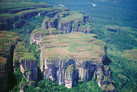
Chiribiquete national park colombia
Chiribiquete National Natural Park (Spanish: Parque Nacional Natural Sierra de Chiribiquete) is the largest national park in Colombia. It was established in 1989 and expanded in 2013. The park occupies 27,800 square kilometres (10,700 sq mi) and includes the Serranía de Chiribiquete mountains and the surrounding lowlands which is covered by tropical moist forest, savannas and rivers.
In August 2013, Chiribiquete National Natural Park was expanded from the previous 1.2 million hectares to 2.8 million hectares. The announcement was made a few days after Ecuador decided to explore for oil within its protected natural parks in the Amazon region.
In 2014, a Colombian photographer and explorer, Francisco Forero Bonell, located and filmed previously reported ancient paintings on rock face within the park.