
Country Guatemala ISO 3166 code GT-CQ Elevation 424 m | Time zone -6 Area 2,376 km² Municipalities 11 | |
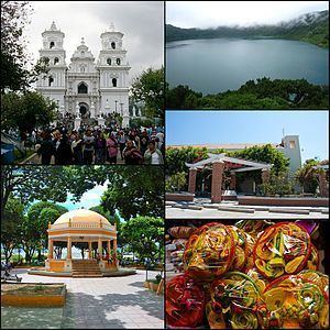 | ||
Points of interest Cathedral Basilica of Esquipulas, Chatún, La Cueva de las Minas, Parque Ismael Cerna, Laguna de el Jute Destinations | ||
Chiquimula guatemala
Chiquimula is a department of Guatemala, in Central America.
Contents
Map of Chiquimula Department, Guatemala
Population
As of 1850, the population was an estimated 80,000.
Municipalities
- Camotán
- Chiquimula
- Concepción Las Minas
- Esquipulas
- Ipala
- Jocotán
- Olopa
- Quezaltepeque
- San Jacinto
- San José La Arada
- San Juan Ermita
Economy
Historically, tobacco was the department's main industry. The area also produced maize, rice, cotton, and beans. Sugar cane was also produced, which was used primarily to make chicha. Cattle, horses and mules were also raised.
References
Chiquimula Department Wikipedia(Text) CC BY-SA