
Length 148 km Country United States of America | Discharge 7.19 m³/s | |
 | ||
River mouth Tittabawassee River600 ft (180 m) Cities Mount Pleasant, Barryton, Garfield Township | ||
The Chippewa River is a stream in the U.S. state of Michigan that runs 91.8 miles (147.7 km) through the central Lower Peninsula. The Chippewa is a tributary of the Tittabawassee River and is thus part of the Saginaw River drainage basin. The river is named after the Chippewa people (the Saginaw Chippewa Tribal Nation is located in Isabella County).
Contents
Map of Chippewa River, Michigan, USA
The main stem of the river begins in northeast Mecosta County in the village of Barryton at 43°44′49″N 85°08′26″W where the north and west branches are impounded. The North Branch Chippewa River, also known as Chippewa Creek (there is a second North Branch Chippewa River further east), rises at 43°52′55″N 85°02′37″W as the outflow of Big Cranberry Lake in Garfield Township in southwest Clare County. The West Branch Chippewa River rises as the outflow of Tubbs Lake, part of a complex of lakes formed by Winchester Dam several miles southwest of Barryton.
The Winchester Dam, built in 1954, impounds 1,420 acres (570 ha) and forms the Martiny Lake Flooding. The dam, which is owned by the State of Michigan, is identified as a "significant hazard due to its proximity to the Village of Barryton." An 1879 atlas of Mecosta County gives an indication of the area's geography before the dam was built. Several of the lakes that now form lobes in a continuous body of water are clearly seen as separate lakes, some with different names or spellings. Tubbs Lake is called "Tebbs Lake" and Diamond Lake is "Dimon Lake".
The "second" North Branch Chippewa River rises as the outflow of Grass Lake near the boundary between Isabella and Clare counties at 43°48′37″N 84°55′33″W and flows south through into the Chippewa River at 43°35′11″N 84°49′50″W a few miles west of Mount Pleasant.
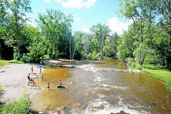
The river flows east into Midland County where it is joined by the Pine River at the Chippewa Nature Center, then joins the Tittabawassee River in downtown Midland under The Tridge. The river flows through Mt. Pleasant and is the focal point of five parks in the city: Riverside Park, Millpond Park, Nelson Park, Chipp-A-Water, and Island Park. In Island Park, the river flows completely around the park and creates a natural island in the center of the city. Three additional Isabella County parks utilize the river for recreation: Meridian Park, Deerfield Nature Park, and Majeski Landing.
The river flows with a mean discharge rate of 254 ft³/s (7.19 m³/s) at its gauge near Mount Pleasant. It is locally known for bass fishing. Chubs and redhorses are also abundant. There are two canoe liveries on the river: Chippewa River Outfitters and Buckley's Mountainside Canoe Livery. The liveries offer canoe, kayak, and tubing trips for a few hours to all day, even an overnight camping trip. The river flows through a gravel pit named Hubsher Gravel Pit. The river is a main water source for the city of Mount Pleasant.
Tributaries and features
From the mouth:
Drainage basin
(Including the Pine River)