
Congressional district 4th Website www.clareco.net Founded 1826 | Area 1,489 km² Population 30,569 (2013) | |
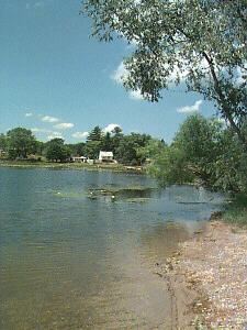 | ||
Points of interest Wilson State Park, Budd Lake, Lingaur Preservation | ||
Visit clare county michigan
Clare County is a county in the U.S. state of Michigan. As of the 2010 census, the population was 30,926. The county seat is Harrison.
Contents
- Visit clare county michigan
- Map of Clare County MI USA
- C mon up to clare county michigan this fall
- History
- Geography
- Features
- Adjacent counties
- Demographics
- Religion
- Government
- Elected officials
- Attractions
- Cities
- Village
- References
Map of Clare County, MI, USA
C mon up to clare county michigan this fall
History
The county was created by the Michigan Legislature from part of Michilimackinac County in 1840, named Kaykakee County. It was renamed Clare County in 1843 after County Clare in Ireland. The county was administered by a succession of other Michigan counties prior to the organization of county government in 1871. Farwell was the first county seat; in 1877 the county seat was moved to Harrison.
Geography
According to the U.S. Census Bureau, the county has a total area of 575 square miles (1,490 km2), of which 564 square miles (1,460 km2) is land and 11 square miles (28 km2) (1.9%) is water. It is considered to be part of Northern Michigan and Central Michigan.
Features
Adjacent counties
Demographics
The 2010 United States Census indicates Clare County had a 2010 population of 30,926. This is a decrease of -326 people from the 2000 United States Census. Overall, the county had a -1.0% growth rate during this ten-year period. In 2010 there were 12,966 households and 8,584 families in the county. The population density was 54.8 per square mile (21.2 square kilometers). There were 23,233 housing units at an average density of 41.2 per square mile (15.9 square kilometers). The racial and ethnic makeup of the county was 95.8% White, 0.5% Black or African American, 0.6% Native American, 0.3% Asian, 1.5% Hispanic or Latino, 0.1% from other races, and 1.3% from two or more races.
There were 12,966 households out of which 25.3% had children under the age of 18 living with them, 51.0% were husband and wife families, 10.0% had a female householder with no husband present, 33.8% were non-families, and 28.0% were made up of individuals. The average household size was 2.36 and the average family size was 2.83.
In the county, the population was spread out with 20.9% under age of 18, 7.9% from 18 to 24, 20.8% from 25 to 44, 30.4% from 45 to 64, and 19.9% who were 65 years of age or older. The median age was 45 years. For every 100 females there were 99.7 males. For every 100 females age 18 and over, there were 97.9 males.
The 2010 American Community Survey 3-year estimate indicates the median income for a household in the county was $33,338 and the median income for a family was $40,983. Males had a median income of $24,220 versus $13,587 for females. The per capita income for the county was $18,516. About 2.3% of families and 23.1% of the population were below the poverty line, including 36.8% of those under the age 18 and 8.5% of those age 65 or over.
Religion
The Roman Catholic Diocese of Saginaw is the controlling regional body for the Catholic Church.
Government
The county government operates the jail, maintains rural roads, operates the major local courts, keeps files of deeds and mortgages, maintains vital records, administers public health regulations, and participates with the state in the provision of welfare and other social services. The county board of commissioners controls the budget but has only limited authority to make laws or ordinances. In Michigan, most local government functions — police and fire, building and zoning, tax assessment, street maintenance, etc. — are the responsibility of individual cities and townships.
Elected officials
(information as of September 2005)
Attractions
Clare County is in the middle of large state forests. Wildlife, including bear, deer, eagles, Kirtland's warblers, and turkeys, are located nearby. Local attractions include:
Activities include: