
Time zone Eastern (EST) (UTC-5) Elevation 152 m Population 63 (2013) Area code 513 | FIPS code 39-14226 Zip code 45112 Local time Saturday 11:58 PM | |
 | ||
Weather 1°C, Wind E at 8 km/h, 61% Humidity Area 62 ha (52 ha Land / 10 ha Water) | ||
Chilo /ˈʃaɪloʊ/ or /ˈtʃaɪloʊ/ is a village in Clermont County, Ohio, United States, along the Ohio River. The population was 63 at the 2010 census.
Contents
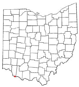
Map of Chilo, OH, USA
History
Chilo was platted in 1816; an early variant name was Mechanicsburgh. A post office called Mechanicsburg was established in 1819, and the name was changed to Chilo in 1823. By the 1830s, Chilo had about twenty houses and two stores.
Geography
Chilo is located at 38°47′40″N 84°8′16″W (38.794447, -84.137813).
According to the United States Census Bureau, the village has a total area of 0.24 square miles (0.62 km2), of which 0.20 square miles (0.52 km2) is land and 0.04 square miles (0.10 km2) is water.
2010 census
As of the census of 2010, there were 63 people, 28 households, and 14 families residing in the village. The population density was 315.0 inhabitants per square mile (121.6/km2). There were 56 housing units at an average density of 280.0 per square mile (108.1/km2). The racial makeup of the village was 98.4% White and 1.6% Native American.
There were 28 households of which 21.4% had children under the age of 18 living with them, 46.4% were married couples living together, 3.6% had a female householder with no husband present, and 50.0% were non-families. 46.4% of all households were made up of individuals and 17.8% had someone living alone who was 65 years of age or older. The average household size was 2.25 and the average family size was 3.29.
The median age in the village was 50.8 years. 14.3% of residents were under the age of 18; 4.7% were between the ages of 18 and 24; 22.2% were from 25 to 44; 36.5% were from 45 to 64; and 22.2% were 65 years of age or older. The gender makeup of the village was 41.3% male and 58.7% female.
2000 census
As of the census of 2000, there were 97 people, 28 households, and 21 families residing in the village. The population density was 315 people per square mile (161.7/km²). There were 48 housing units at an average density of 241.1 per square mile (92.7/km²). The racial makeup of the village was 97.94% White, 1.03% Native American, 1.03% from other races.
There were 39 households out of which 20.5% had children under the age of 18 living with them, 48.7% were married couples living together, 5.1% had a female householder with no husband present, and 43.6% were non-families. 35.9% of all households were made up of individuals and 15.4% had someone living alone who was 65 years of age or older. The average household size was 2.49 and the average family size was 3.23.
In the village, the population was spread out with 24.7% under the age of 18, 7.2% from 18 to 24, 20.6% from 25 to 44, 27.8% from 45 to 64, and 19.6% who were 65 years of age or older. The median age was 44 years. For every 100 females there were 115.6 males. For every 100 females age 18 and over, there were 82.5 males.
The median income for a household in the village was $38,333, and the median income for a family was $51,250. Males had a median income of $26,250 versus $26,250 for females. The per capita income for the village was $15,197. There were 4.8% of families and 12.4% of the population living below the poverty line, including 22.7% of under eighteens and 5.6% of those over 64.