
Country Japan Prefecture Ibaraki Prefecture Area 205.3 km² Local time Sunday 9:01 AM | Region Kantō - Tree Sakura Population 108,527 (2010) Bird Barn swallow | |
 | ||
Time zone Japan Standard Time (UTC+9) - Flower Japanese pear and cosmos Weather 7°C, Wind NE at 6 km/h, 77% Humidity | ||
Chikusei (筑西市, Chikusei-shi) is a city located in Ibaraki Prefecture, in the northern Kantō region of Japan. As of September 2015, the city had an estimated population of 104,136 and a population density of 507 persons per km². Its total area was 205.30 km².
Contents
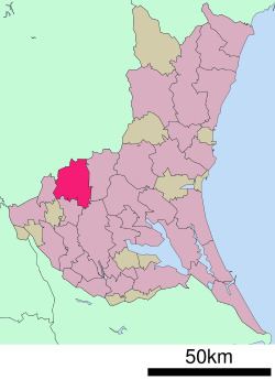
- Map of Chikusei Ibaraki Prefecture Japan
- Geography
- Surrounding municipalities
- History
- Education
- Train
- Highway
- Local attractions
- Noted people from Chikusei
- References
Map of Chikusei, Ibaraki Prefecture, Japan
Geography
Located in southwestern Ibaraki Prefecture, Chikusei is located on the west side of Mount Tsukuba and is bordered by Tochigi Prefecture to the north. The Kinugawa River and the Kokaigawa River flow through the city. The city is located about 70 kilometers north of downtown Tokyo.
Noted products of Chikusei include koshihikari (rice), nashi (pears), small watermelons, cucumbers, strawberries, and tomatoes.
Surrounding municipalities
History
During the Edo period, parts of the modern city of Chikusei were administered by Shimodate Domain, one of the feudal domains of the Tokugawa shogunate. With the creation of the municipalities system after the Meiji Restoration on April 1, 1889, the town of Shimodate,was established within Makabe District, Ibaraki). Shimodate was raised to city status on March 15, 1954
The modern city of Chikusei was established on March 28, 2005, from the merger of the city of Shimodate, and towns of Akeno, Kyōwa and Sekijō (all from Makabe District)
Education
Chikusei has 20 elementary schools, 7 middle schools and 4 high schools.