
 | ||
Floor elevation approx. 2,600 feet (800 m) Similar Chicamocha National Park, Parque Natural El Gallineral, Tatacoa Desert, Lake Tota, Salt Cathedral of Zipaqui | ||
Paragliding high above the chicamocha canyon san gil colombia
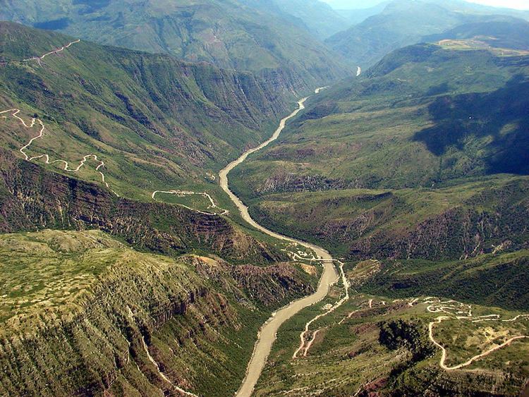
The Chicamocha Canyon (CHEE-kah-MOW-cha) is a steep sided canyon carved by the Chicamocha River. This river flows through the departments of Boyacá and Santander, where it reaches its maximum depth near the outskirts of Bucaramanga.
Contents
- Paragliding high above the chicamocha canyon san gil colombia
- Map of Chicamocha Canyon Colombia
- Chicamocha canyon santander colombia
- EtymologyEdit
- References
Map of Chicamocha Canyon, Colombia
The canyon is the result of the erosion caused by water. It created deep cliffs on both sides. The Chicamocha Canyon begins near the town of Soatá in the Department of Boyacá and flows mainly through the Department of Santander, extending all the way to the municipality of Lebrija. This geographic feature was caused by the movement of tectonic plates that extend from the Chicamocha canyon to other regions such as Bucaramanga.
The canyon extends over 108,000 acres and 2000 meters in depth. The canyon was formed about 46 million years ago. On this territory many million years ago, there was a lake that hosted many marine animals whose remains have been found. The canyon is currently administered by Chicamocha National Park.
In 2009, the canyon was nominated as one of the 7 natural wonders contest.
Chicamocha canyon santander colombia
EtymologyEdit
The name Chicamocha in the Chibcha language of the Muisca means "silver-plated son, under the moon on the mountain range".