
Time zone WAT (UTC+1) Area 1,350 km² | Postal code 601 Elevation 417 m | |
 | ||
Boko haram how 3 chibok girls escaped to safety in nigeria
Chibok is a Local Government Area of Borno State, Nigeria, located in the north of the state. Its headquarters are in the town of Chibok. It has an area of 1,350 km² and a population of 66,105 at the 2006 census.
Contents
- Boko haram how 3 chibok girls escaped to safety in nigeria
- Map of Chibok Nigeria
- Chibok schoolgirls kidnapping
- References
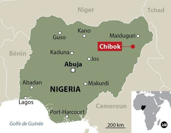
Map of Chibok, Nigeria
The town of Chibok is primarily a Christian village with a Muslim minority. Most of the village speaks the Kibaku language.
On 14 November 2014 it was reported that the Islamist group Boko Haram has taken control of the town and implemented the Sharia law.
It is one of the sixteen LGAs that constitute the Borno Emirate, a traditional state located in Borno State, Nigeria.
In January 2015, the BringBackOurGirls group aired concerns over plans by the Independent National Electoral Commission (INEC) to exclude Chibok and some communities currently under the control of Boko Haram from receiving permanent voter cards (PVCs) for the 2015 Nigerian general election.
Chibok schoolgirls kidnapping
In 2014, nearly 300 mainly Christian girls were abducted from Chibok by the Islamist militant group Boko Haram.