
Country Thailand Postal code 55160 Area 277.1 km² Province Nan Province | Time zone THA (UTC+7) Geocode 5509 Population 28,234 (2009) | |
 | ||
Chiang Klang (Thai: เชียงกลาง, [t͡ɕʰīa̯ŋ klāːŋ]) is a district (Amphoe) in the northern part of Nan Province, northern Thailand.
Contents
Map of Chiang Klang District, Nan, Thailand
Geography
Neighbouring are from the north clockwise Thung Chang, Pua, Tha Wang Pha and Song Khwae.
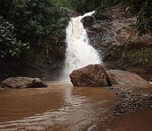
The eastern part of the district is located in the Luang Prabang Range mountain area of the Thai highlands.
History
The minor district (King Amphoe) was created on June 20, 1968, when the four tambon Puea, Chiang Klang, Chiang Khan and Na Rai Luang were split off from Thung Chang district. It was upgraded to a full district on November 16, 1971.
Administration
The district is subdivided into 6 subdistricts (tambon), which are further subdivided into 59 villages (muban). There are 2 townships (thesaban tambon) in Chiang Klang district. The first one is Chiang Klang, which covers parts of tambon Chiang Klang, Puea and Phaya Kaeo. Another one is Phra Phutthabat Chiang Khan, which covers the whole area of tambon Phra Phutthabat and Chiang Khan. There are further 4 Tambon administrative organizations (TAO).
The missing numbers are the tambon which now form Song Khwae district.