
Country Thailand Tambon 7 Time zone ICT (UTC+7) Area 836.9 km² Postal code 57140 | Seat Wiang Muban 102 Geocode 5703 Population 64,197 (2015) Province Chiang Rai Province | |
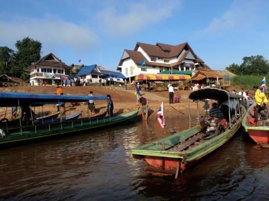 | ||
Chiang Khong (Thai: เชียงของ; [tɕʰīaŋ kʰɔ̌ːŋ]) is a district (amphoe) in the northeastern part of Chiang Rai Province, northern Thailand.
Contents
- Map of Chiang Khong District Chiang Rai Thailand
- Geography
- Central administration
- Local administration
- References
Map of Chiang Khong District, Chiang Rai, Thailand
Geography
The Phi Pan Nam mountains and their wide intermontane basins dominate the landscape of the district. The 1,328 m high Doi Luang Pae Mueang massif (ดอยหลวงแปเมือง) rises west of Chiang Khong town. The Mekong River flows at the northern end of the district, partially forming the boundary with Laos. Another important river is the Ing, a tributary of the Mekong.
Neighboring districts are (from the southeast clockwise) Wiang Kaen, Khun Tan, Phaya Meng Rai, Wiang Chiang Rung, Doi Luang, Chiang Saen of Chiang Rai Province. To the east is Bokeo Province of Laos.
Due to its location, the district forms a gateway to the neighboring country. Communication is mostly by boat, including the popular slow boat to Luang Prabang. Also bus travel on Asian Highway 3 from Ban Houayxay across the river to Boten at the Chinese-Laotian boundary is available. The Fourth Thai–Lao Friendship Bridge crossing the river opened mid-December 2013.
Central administration
The district Chiang Khong is subdivided into 7 subdistricts (Tambon), which are further subdivided into 102 administrative villages (Muban).
Missing numbers belonged to the tambon which now form Wiang Kaen District.
Local administration
There are 7 subdistrict municipalities (Thesaban Tambon) in the district:
There is one subdistrict administrative organization (SAO) in the district: