
Area 584 km² | Time zone EET (UTC+2) Population 30,524 (Dec 2009) | |
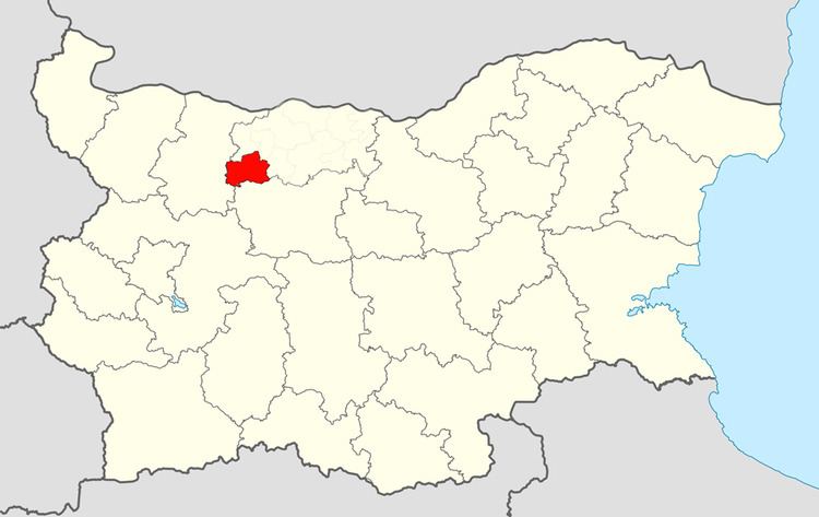 | ||
Cherven Bryag Municipality (Bulgarian: Община Червен бряг) is a municipality (obshtina) in Pleven Province, northwestern Bulgaria. It is named after its administrative centre - the town of Cherven Bryag. With a population of 30,524, as of December 2009, it is the second largest municipality in the province.
Contents
Map of Cherven bryag, Bulgaria
The municipality is located by the right side of the Iskar River, close to the inlet of Zlatna Panega River. It has area of 584 km2.
It borders with Lukovit, Roman, Dolni Dabnik, Iskar, Knezha and Byala Slatina municipalities. The Sofia - Rousse highway and Sofia-Varna railroad pass through municipality.
The municipality has 37 protected areas, including Kuklite ("The Dolls") rock formations on the lands of Resselets village; Kaleto tectonic ridge on the lands of Reselets village; Skoka waterfall on the lands of Reselets; Haydoushka cave near Deventsi; Sedlarkata Rock Bridge on the lands of Rakita; Neolithic settlements near Telish, Thracian settlements in Chomakovtsi, Roman cites near Resselets and Chomakovtsi.
Demography
The following table shows the change of the population during the last four decades.