Joseph Harrison, who had married Mary Ann Thompson, settled on a block in the area in 1839, planted orchards and built a small timber cottage they called "Cherrybrook Cottage". The name "Cherrybrook" is believed to have come from the fact they grew cherry trees near the creek, which passed through their land. Their 65-acre (260,000 m2) block, which became known as "Cherrybrook Farm", had been granted originally to Mary Russell during the 1820s. The orchards here produced peaches, apricots, pears, plums, and citrus fruit. Many years later the property was bought by Eric Vaux, who established a dairy and kept the name Cherrybrook.
In February 1959, the land was subdivided to become the first project home village in Sydney. The original bushland was bulldozed, and exhibition homes were built on cut and fill sites, then landscaped. Accelerated development occurred again in the remaining rural areas in the 1980s, and Cherrybrook Post Office opened on 20 July 1994.
Many of Cherrybrook's streets are named after native plants, trees, historical figures from convict times or local landowners. When Cherrybrook was subdivided from 1959 onwards, the developers chose colonial architects as a theme for naming some streets. None of the colonial architects and surveyors were associated with or lived in Cherrybrook.
Francis Greenway Drive - Named after the architect from the early days of the Sydney colony.Macquarie Drive - Named after the fifth Governor of NSW, Major-General Lachlan MacquarieLambe Place - David Lambe (1802–1843), architect and farmer, was born in London in 1802. In May 1823 he sought employment in Van Diemen's Land and in August he received a promise of a grant of land. Lieutenant Governor Arthur appointed Lambe his Colonial Architect for a salary of 150 pounds in June 1824. He is remembered for his connections with some of Tasmania's oldest extant buildings.Dawes Place - William Dawes (1762–1836) was a surveyor who laid out Sydney and Parramatta, and built the first observatory in Australia, at what is now Dawes Point, Sydney.Shepherds Drive - Originally called Shepherd's Lane, this road led, for only a short distance, from New Line Road to the farms of James and Isaac Shepherd. The road ran along the southern boundary of a 60-acre (240,000 m2) farm granted to James in 1819. He also owned 30 acres (120,000 m2) on the other side of New Line Road. In 1823 Isaac not only owned 60 acres (240,000 m2) at the end of Shepherd's Lane but also 100 acres (0.4 km2) on the southern side of Thompsons Corner, New South Wales. In 1833 Isaac acquired a further 100 acres (0.4 km2) at the end of Shepherd's Lane.Purchase Road - John Purchase acquired 189 acres (0.8 km2) of land at the end of this road in 1854. This road at first was his driveway. He had migrated to Australia in 1838 at the age of 32 with his wife Betsy. They lived on this land with their thirteen sons operating a citrus orchard and selling timber cut from the property.Booth Place - Named after the Booth family who owned this land.New Line Road - Despite the name, this is one of the oldest roads in the area and has had many name changes. In 1828 it was "New North Road" in contrast with "Old Northern Road" which it joins at Dural. On re-alignment in 1845 it was named "The New Public Northern Road".Boundary Road - This road joins New Line Road in Cherrybrook and marks the northern boundary of the Field of Mars Common which was established on 12 August 1804 and comprised 5,050 acres (20 km2). It did not join New Line Road until the 1960s.Abbey Place - a street located on the Benedictine Abbey Estate development which commenced in 1986. An abbey was built on the site in 1957 but was demolished on 31 May 1988. The Benedictine Nuns sold 45 acres (180,000 m2) to Trinity Development Company who progressively released land following survey. Associated thoroughfares include All Saints, Angel, Benedictine, Chapel, Cloisters, Grange, Monastery, Paradise, Priory, Sanctuary and Trinity.Paxton Close - also associated with the Benedictine Order. Paxton is a made-up word meaning "a ton of pax (peace)" Pax is a motto of the Benedictine Order which built and Abbey here in 1957. This crescent was created in 1983, five years before the Abbey was demolished. The name "Benedict" was selected at first but was refused.Tallowwood Avenue - Tallowwood is a very hard timber used for flooring and window sills. It comes from the tree Eucalyptus microcorys.Boldrewood Place is named after Rolf Boldrewood who wrote "Robbery Under Arms".Gumnut Road - Gumnuts are the woody seed capsules produced after a gum tree has flowered. This road was formerly called Pogson's Lane until the 1920s.Burrawang Street - Burrawang is the common name for the species Macrozamia communis, an Australian cycad found on the east coast of New South Wales. The word burrawang is derived from the Dharuk language and means "wild duck".Cherrybrook is serviced by Hillsbus with routes linking to Sydney CBD and Cherrybrook railway station, which is on the North West Rapid Transit of the Sydney Metro network, is under construction and is due to open in 2019.
M60 - Hornsby to Parramatta600 - Cherrybrook to Parramatta (Limited weekday peak hour services). Usually between Castle Hill and Parramatta.620 - Dural to Town Hall620X - Dural to Town Hall via Lane Cove Tunnel621 - Castle Hill to Town Hall peak hour to Macquarie Park only622 - Dural to North Sydney via Lane Cove & St Leonards626 - Dural to Pennant Hills642 - Round Corner to Town Hall642X - Round Corner to Town Hall via Lane Cove TunnelCherrybrook Village Shopping Centre (owned by Mirvac [1]) is a fully enclosed, single level neighbourhood shopping centre that has Woolworths as its major tenant. It opened in 1989 and was refurbished in 2004. Appletree Shops is a smaller shopping centre.
Cherrybrook is serviced by a number of educational institutions, including Cherrybrook Nursery and Preschool, ABC Developmental Learning Centre, Kindalin Early Childhood Learning Centre, Cherrybrook Community Pre-School, Cherrybrook Public School, John Purchase Public School, Cherrybrook Technology High School, Tangara School for Girls, and Inala, a Rudolf Steiner school supporting individuals with disabilities.
Cherrybrook Technology High School (CTHS) is currently the largest government secondary school in the state with over 2000 students and is growing larger each year, although it was built to accommodate 900 students.
Cherrybrook has a large number of Christian churches of many denominations:
Cherrybrook Anglican Church, located in Cherrybrook Community and Cultural CentreCherrybrook Uniting ChurchCherrybrook Presbyterian ChurchC3 Church Cherrybrook, formerly Victory Community Christian Church (http://www.victoryccc.com.au/)Cherrybrook Community Life Church (CCLC), a Baptist / non-denominational community churchSt Matthews Asian Congregation, located in Cherrybrook Public SchoolThere is also a Buddhist Mahāyāna Monastery.
According to analysis published by Hornsby Council, the largest changes in Cherrybrook residents' religious affiliations from the census in 2006 to 2011 were for those who nominated:
No Religion (+587 persons)Hinduism (+295 persons)Western Catholic (-283 persons)Anglican (-274 persons)Uniting Church (-165 persons)Sport and recreation
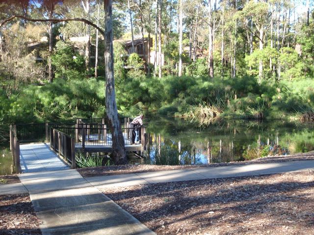
Recreation areas include Greenway Park (featuring Indoor Heated Swimming Pool and a fenced Dog Park), The Lakes of Cherrybrook, Edward Bennett Oval (Soccer, Cricket), Thomas Thompson Park (Tennis, Soccer, Cricket) and a number of other small parks. Cherrybrook also has a number of walking trails and fire trails that are part of the Berowra Bushland Reserve, including the Callicoma Walk. Cherrybrook has a large Baseball community with over 500 playing members who call Greenway park home for the Greenway Giants Baseball Club.
According to the 2011 census there were 18,778 residents in Cherrybrook. Of these:
48.8% were male and 51.2% were female.The median age was 40 years, compared to the national median of 37. Children aged 0-14 years made up 18.9% of the population and people aged 65 years and over made up 12.5% of the population.53.7% were born in Australia. The next most common countries of birth were India 4.7%, England 4.3%, China (excludes SARs and Taiwan) 3.6%, Hong Kong (SAR of China) 3.2% and South Africa 3.0%The most common ancestries were English 20.5%, Australian 18.7%, Chinese 12.8%, Irish 6.0% and Indian 5.7%.62.3% of people only spoke English at home. Other languages spoken at home included Cantonese 7.0%, Mandarin 4.9% and Korean 2.6%.The most common responses for religion were Catholic 23.7%, No Religion 17.1%, Anglican 17.1%, Hinduism 5.4% and Uniting Church 5.3%The most common occupations in Cherrybrook were Professionals 33.8%, Managers 17.0% and Clerical and Administrative Workers 16.3%.Jai Courtney, actorRebel Wilson, actorKieren Jack, Sydney Swans AFL footballerGarry Jack, former NSWRL Balmain player and father of Kieren and Brandon JackAlaina Taylor, contestant revealed as The Mole in The Mole, 2002Brandon Jack, Sydney Swans AFL footballer