
PIN 680604 Local time Saturday 12:50 PM Area code +914885 | Time zone IST (UTC+5:30) Telephone code +914885 Population 10,775 (2001) | |
 | ||
Weather 33°C, Wind W at 10 km/h, 57% Humidity University Royal College of Engineering & Technology | ||
Chermanangad (Cheramanagad / Chiramanangad) is a small village on the road between Kunnamkulam & Wadakanchery (Road No. SH50) in the Thrissur district of Kerala.
Contents
Map of Chiramanangad, Kerala
History
A prehistoric burial site, commonly known as Kodakuthy Kallu (Kudakallu) [literally meaning "stones shaped like umbrellas"], were discovered here. These burial sites had stones placed like umbrellas over them. These stones have been over a period of time been plundered for construction and remaining stones shifted to museums.
These umbrella rocks of Chiramanangad are reported to have a history of over four thousand years, here people were buried in earthen urns and umbrella rocks were placed on top as landmarks.
Economy
This largely rural area is gradually being converted to a small urban centre. Agricultural activity is disappearing with agricultural land being converted to housing plots. The village centre has a temple known as Kunnambathu Kavu.
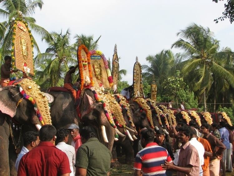
Festivals
Every year Pooram is held at the village temple grounds on the 10th day of Malayalam month of Medam
i.e. approximately mid April as per Gregorian calendar.
Transportation
Nearest Railway Station: Thrissur, Wadakanchery
Nearest Major Town: Kunnamkulam, Guruvayur
Demographics
As of 2001 India census, Chiramanangad had a population of 10775 with 5126 males and 5649 females.