
Hangul 천상열차분야지도 | Hanja 天象列次分野之圖 | |
 | ||
Revised Romanization Cheonsang Yeolcha Bunyajido McCune–Reischauer Ch'ŏnsang Yŏlch'a Punyajido | ||
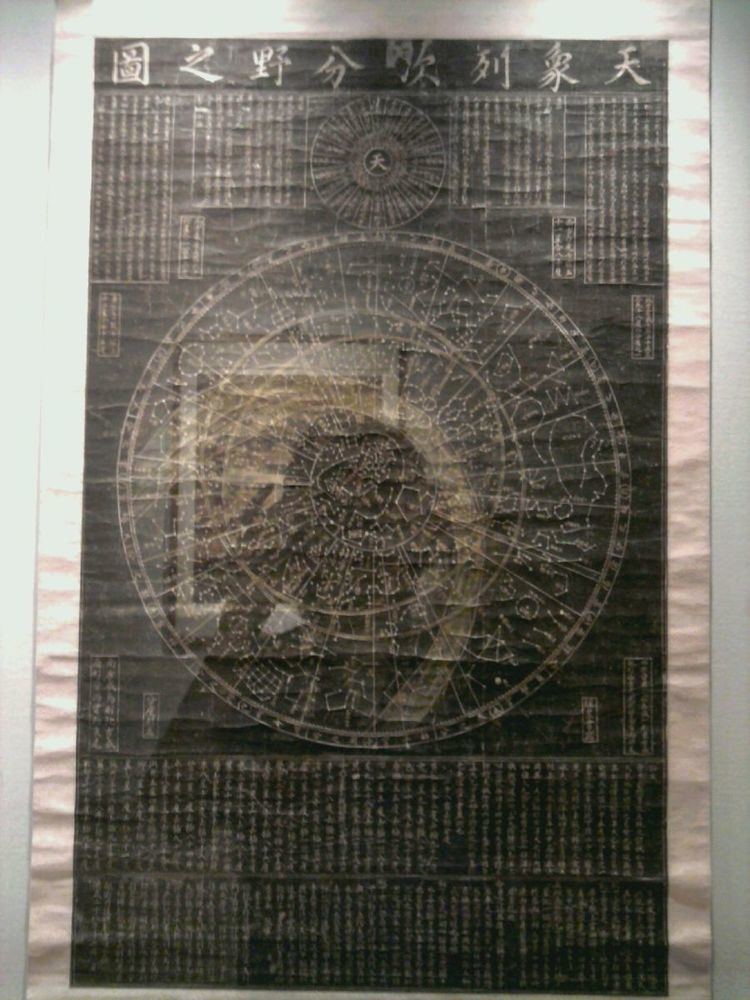
Cheonsang Yeolcha Bunyajido is a fourteenth-century Korean star map, copies of which were spread nationwide in the Joseon Dynasty. The name is sometimes translated as "chart of the constellations and the regions they govern."[1]
King Taejo ordered royal astronomers to carve the constellations on a flat black stone in December 1395. The stone was about 122.5 cm in width, 211 cm in height, and 12 cm in depth. The engraved stone shows 1,467 stars, 264 constellations and their names, the ecliptic and equatorial lines, and 365 scales around. It was compiled through a combination of a Goguryeo star map with more recent observations.[2]
The map showed positions of the heavenly bodies in their natural order and allocated on their respective celestial fields. Its map projection law is found to be the polar equatorial and equidistance projection : the linear distance of an object on the map from the center is lineally proportional to the north polar angular distance.
The epoch of the stellar positions is estimated to be near the First Century for the stars with declination less than fifty degrees, and to be near 1395 AD for stars with declination higher than fifty degrees.
This map became standard during the Joseon dynasty, with numerous copies printed and disseminated throughout the kingdom, until it was superseded by Western planispheres in the nineteenth century.
The map is the 228th national treasure of South Korea, and is kept in the Korean Royal Museum in Seoul.
The map is now used as a background image on the reverse of the 2007 issued 10,000 won banknotes.