
State Tamil Nadu | Area 1,189 km² | |
 | ||
Districts Chennai
Kancheepuram
Tiruvallur Demonym(s) Chennaivasi, Chennaiite Time zone Indian Standard Time (UTC+5:30) | ||
Dr anbumani ramadoss speech about new urban agenda for chennai metropolitan area 16 03 2016
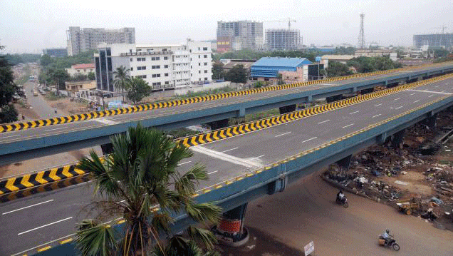
The Chennai Metropolitan Area is the fourth most populous, and the fourth largest metropolitan area in India and is the 22nd most populous city in Asia or the 40th most populous city in the world. The CMA consists of the metropolitan city of Chennai (Madras) and its suburbs. The Chennai Metropolitan Development Authority (CMDA) is the nodal agency that handles town planning and development within the metro area. Since 1974, an area encompassing 1189 km2 around the city has been designated as the Chennai Metropolitan Area (CMA) and the CMDA has been designated as the authority to plan the growth of the city and the area around it.
Contents
Economy
Chennai city economy of US$58.6 billion PPP (US$17 billion nominal GDP, 2010) is currently rated the fourth-largest economy in India, ahead of the Bangalore Metropolitan Area and after the Kolkata Metropolitan Area.
Composition
The CMA has an area of 1,189 km² spread over three districts. It includes the whole of the Chennai District, along with the Ambattur, Gummidipoondi, Madhavaram, Ponneri, Poonamallee and Tiruvallur taluks of the Tiruvallur District, and the Alandur Kanchipuram, Sholinganallur, Sriperumbudur and Tambaram taluks of the Kanchipuram District.
The City of Chennai (not to be confused with the Chennai District) currently covers an area of 426 km2 and now includes adjoining sections of Tiruvallur and Kanchipuram Districts along with the 176 km2 of the Chennai District. Prior to the expansion of the city's boundaries in September 2011, the city of Chennai (administered by the Chennai Corporation) fell completely within the Chennai District. There hasn't been any published update for the metropolitan population for the 2011 census, but the 3 districts in their entirety were home to over 12 million people in the 2011 census. Chennai City Limit Covers West side up to Poonamallee Taulk, Karanodai Near Redhills,Towards East Side ECR and OMR up to Kovalam Kelambakkam Region, North side Covers Manali Region and Minjur, towards South City Limit covers up to Vandalur Gate way of Chennai. Rest not covers within Real Chennai City Region.
The Chennai Metropolitan Area is set to be expanded further, incorporating the entire districts of Tiruvallur and Kancheepuram, and the Arakkonam taluk of the Vellore district.
Profile
Chennai (Madras), the capital City of Tamil Nadu is the fourth largest Metropolitan City in India. The Chennai Metropolitan Area (CMA) comprises the city of Chennai, 16 Municipalities, 20 Town Panchayats and 214 Village Panchayats in 10 Panchayat Unions. The extent of CMA is 1189 km2.
The CMA falls in three Districts of the Tamil Nadu State viz. Chennai District, part of Thiruvallur District, and part of Kancheepuram District. The extent of the Chennai District (covered in Chennai Municipal Corporation area) is176 km2 and comprises 55 revenue villages in 10 Taluks [viz. (i) Tondiarpet Taluk, (ii) Perambur Taluk, (iii) Purasawalkam Taluk, (iv) Egmore Taluk, (v) Mambalam Taluk, (vi) Guindy Taluk, (vii) Mylapore Taluk, (viii) Velachery Taluk, (ix) Aminjikarai Taluk and (x) Ayanavaram Taluk. In Thiruvallur District out of total district area of 3427 km2, 637 km2. in Ambattur, Thiruvallur, Ponneri and Poonamallee taluks fall in CMA. In Kancheepuram District out of 4433 km2, 376 km2 in Tambaram, Sriperumbudur and Chengalpattu Taluks fall in the Metropolitan area.
CMA region has about 3,000 water bodies, most of which have been encroached upon by real estate dealers and small communities.
Expansion
The CMDA regulates developments in the Chennai Metropolitan Area through the issuance of planning permission under section 49 of the Tamil Nadu Town and Country Planning Act 1971.
The first plans to expand the CMA were proposed by the CMDA in 2011. The need for expansion arose as several nearby settlements such as Sriperumbudur, Kelambakkam, Tiruvallur and Maraimalai Nagar had been undergoing rapid development and had to be incorporated under the CMDA planning strategy. Also, the planning bodies of other metropolises in India such as Bengaluru, New Delhi and Hyderabad had already redefined their respective metropolitan regions to include much larger areas and corresponding regional planning was being done. The CMA, however, hasn't been altered since it was first defined in 1974. The area was limited to 1,189 km2 (459 sq mi) which is among the smallest in the country.
In July 2012, the CMDA suggested two options to the Government of Tamil Nadu for expanding the area:
Chief planners of the CMDA have suggested that the second option is more feasible. Another planning model, similar to the National Capital Region was also examined by the CMDA. In order to plan for balanced regional development, developing a larger road network, implementing an integrated transport plan and identifying a Chennai Mega Region have become necessary.