
Local time Saturday 1:19 PM | Province Taiwan Province | |
 | ||
Weather 21°C, Wind S at 8 km/h, 70% Humidity Points of interest Sanxiantai, Old Donghe Bridge, Amis Folk Center, Baishoulian Riverside Park | ||
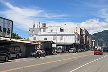
Chenggong Township (Chinese: 成功鎮; pinyin: Chénggōng Zhèn; Wade–Giles: Ch'eng2-kung1 Chen4; Pe̍h-ōe-jī: Sêng-kong-tìn) is an urban township in Taitung County, Taiwan. It is a coastal town facing the Pacific Ocean. Fishery Harbor is just west of downtown.
Contents
- Map of Chenggong Township Taitung County Taiwan 961
- History
- Geography
- Climate
- Administrative divisions
- Demographics
- Economy
- Tourist attractions
- Transportation
- References
Map of Chenggong Township, Taitung County, Taiwan 961
History
Chenggong was originally an Amis settlement from which came the Hokkien name Moalaulau (Chinese: 麻荖漏; Pe̍h-ōe-jī: Môa-láu-lāu). During Japanese rule, it was renamed to Shinkō Town (Japanese: 新港街) of Taitō Prefecture. After 1945, to avoid confusion with Xingang Township of Chiayi County and to distinguish it from Tainan's Sinckan (now called Xinshi), it was changed to Chenggong, which commemorates Zheng Chenggong who expelled the Dutch.
Geography
The township has 14,943 inhabitants and its total area is 144.9938 km². The majority inhabitants of the township are the Amis people which makes up to 53% of the population.
Climate
Along with the most of the rest of Taitung County, Chenggong has a tropical monsoon climate.
Administrative divisions
Demographics
Amis people are the majority ethnic group in the township.