
- elevation 0 ft (0 m) | ||
 | ||
- location Boston, Massachusetts, United States | ||
Chelsea creek ma flames of fall enya storyofasaltmarsh 720hd
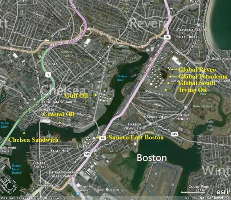
Chelsea Creek, shown on federal maps as the Chelsea River, is a 2.6-mile-long (4.2 km) waterway that runs along the shore of Chelsea, Massachusetts and separates that community from the cities of Boston and Revere as well as feeding part of the current Belle Isle Marsh Reservation that separates Boston from Revere. The creek starts as Mill Creek at a former pond at the intersection of Revere Beach Parkway (Massachusetts Route 16) and U.S. Route 1, now a shopping center. Mill Creek meanders east for 0.5 miles, then takes a sharp turn south, becoming Chelsea Creek, and widens significantly as it runs between Chelsea and the neighborhood of East Boston. In that area the waterway is used by oil tankers to transport fuel to adjacent oil tanks. The creek then turns southwest and runs into the Mystic River shortly before it empties into Boston Harbor.
Contents
- Chelsea creek ma flames of fall enya storyofasaltmarsh 720hd
- Map of Chelsea River Massachusetts USA
- Chelsea creek ma hide and paddle seek ingridmichaelson storyofasaltmarsh 720hd
- CrossingsEdit
- References
Map of Chelsea River, Massachusetts, USA
In May 1775, the colonists won their first offensive victory of the American Revolution over the British in a naval battle known as the Battle of Chelsea Creek.