
 | ||
Similar Chelsea Bridge, Chelsea Barracks, Sloane Square tube station, Hawker Building, Royal Hospital Chelsea | ||
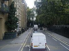
Driving in london battersea park to chelsea bridge road
Chelsea Bridge Road is the modern eastern boundary of Chelsea, in the Royal Borough of Kensington and Chelsea, London, England. To the northeast is the district of Pimlico in the City of Westminster.
Contents
- Driving in london battersea park to chelsea bridge road
- Map of Chelsea Bridge Rd London SW3 4SL UK
- Chelsea bridge road crash london 22 09 2013
- References
Map of Chelsea Bridge Rd, London SW3 4SL, UK
The road runs between Chelsea Bridge on the Chelsea Embankment, which the River Thames to the southeast and a junction with Royal Hospital Road, Lower Sloane Street and Pimlico Road to the northwest. The closest tube station is Sloane Square to the north along Lower Sloane Street. The road is part of the A3216 route.
Immediately to the southwest are Ranelagh Gardens. Beyond that are the grounds of the Royal Hospital Chelsea. Also close by is the National Army Museum, next to the Royal Hospital Chelsea on Royal Hospital Road. The Lister Hospital is on Chelsea Bridge Road.