
Postal code M4, M7, M8, M25, M45 Majorjunctions A665 road Length 8 km | Other name Bury Old Road | |
 | ||
Former name(s) York Street, Cheetham (part) Location | ||
Lahori dera manchester cheetham hill road
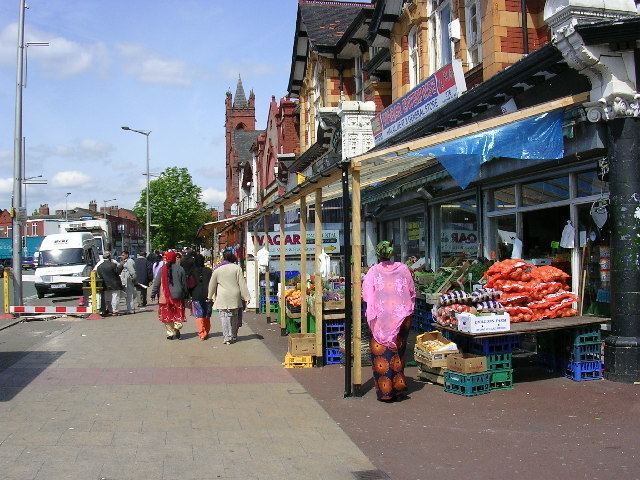
Cheetham Hill Road is a road in North Manchester, running from Corporation Street in Manchester city centre to Prestwich. In Crumpsall 53°30′44″N 2°14′38″W, its name changes to Bury Old Road. It is lined with churches, mosques, synagogues and temples, as well as substantial terraced houses.
Contents
- Lahori dera manchester cheetham hill road
- Map of Cheetham Hill Rd Manchester UK
- Route
- History
- Offices
- Civic Buildings
- Churches
- Synagogues
- Public transport
- References
Map of Cheetham Hill Rd, Manchester, UK
Route
Cheetham Hill Road and Bury Old Road are part of the designated A665. Currently, Cheetham Hill Road starts at the junction of the A6042 Corporation Street and the A665 Miller Street. It crosses the culverted River Irk to the east of Victoria Station. At its junction with New Bridge Street, it turns north-northeast and is straight for 1 km, to the A6010 Queen's Road (east side). This stretch was called York Street until about 1900. Cheetham Hill Road leads from here to the community of Cheetham Hill, where at Bourget Street and Crescent Road (formerly Sandy Lane), Cheetham Hill Road becomes Bury Old Road. This is the boundary between Manchester and Salford; and the boundary between postcodes M8 and M7. To the north-west is Crumpsall and to the south-east is Broughton Park. It crosses the A567 Middleton Road and passes into Prestwich, Bury, in the M25 postcode area. To the east is the broad expanse of Heaton Park, and to the west is the Heaton Park Metrolink station. Bury Old Road passes over the M60 motorway and under the Bury metrolink tram line at Besses o' th' Barn Metrolink station. At Whitefield (M45 postcode) Bury Old Road joins with A56 Bury New Road, the 1827 toll road that was built to replace it.
Bury New Road is a feeder to junction 17 of the M60 (formerly M62), the trans-Pennine motorway and, here, the Manchester ring road.
History
Roman Manchester ran from the castrum (fort) at the Medlock crossing in Castlefield, along Deansgate to the crossing of the River Irk at the foot of Red Bank. Cheetham Hill Road starts at the River Irk crossing. The course of the Roman road has not been determined, though it is likely that there was a path that followed Red Bank up the sandstone river cliff following the gentle gradient that was preferred by draught animals. Cheetham, with its other spelling Chetham is an interesting name, the first syllable is a Celtic pre-Roman given name, while the suffix ham, meaning settlement has a Mercian or Northumbrian post-Roman name. Almost all Manchester placename are post-Roman; this implies that Cheetham was of sufficient importance in Roman times for the Celtic name to survive. .
In the Middle Ages the land was ceded to Roger de Midleton and he leased it to a Henry, who was referred to as Henry de Chetham. A descendant was Humphrey Chetham who was born at Crumpsall Hall in 1580, and his descendant was Edward Chetham who died without issue in 1769. Crumpsall Hall stood at the junction of Cheetham Hill Road, Sandy Lane (Crescent Road) and Humphrey Street, it was demolished in 1825. A new Crumpsall Hall was built in Crumpsall Park 300m away.
A further important estate was Stocks, this was at the corner of Dirty Lane (Elizabeth Street) and Cheetham Hill Road. Indeed, here to Sandy Lane was the only section called Cheetham Hill Road. At Stocks the main road into Manchester passed by North Street and Red Bank and over the bridge into Long Millgate as described earlier. A new road called York Street cut through from here to New Bridge Street and the Miller Street Corporation Street Junction. (possibly in 1757). York Street was renamed Cheetham Hill Road around the turn of the nineteenth century due to the large number of York Streets in central Manchester. York Street and its parallel streets were a planned development with elements of a gridiron structure.
In the late 1830s, the very wealthy were living in villas in Crumpsall, leaving the a range of relatively cheap and spacious houses along York Street that were ideal for the traders with retail properties in town, and along Deansgate. The Jewish community had expanded into retailing-taking the skill of the hawker into fixed shops. Jacob Frank, an optician, to take an example, opened a shop at 114 Deansgate, where 8 of his 11 sons became opticians: the three others moved away to open different shops in Leeds and Hull. Benjamin Hyam, who opened his Pantechnethica at 26 Market Street in April 1841 moved to Higher Broughton. Successful retailers moved from garrets above their shops in town to the new inner suburbs. Joseph Braham moved onto York Street in 1841 and bought other houses which he tenanted with his co-religionists. By 1845 there were 12 Jewish retailers living along York Street or close by. In 1858 two synagogues opened on York Street- the Great Synagogue and the Reformed Synagogue. Others were to follow.
Offices
Civic Buildings
Churches
Synagogues
Public transport
The 135 Manchester-Bury bus runs the entire length of the road. The lower end is also served by the 88, 89 Circular Piccadilly Moston service. On other parts of the road the 51A, 149, 154 and 167 services will be found.