
Vehicle registration JH | Time zone IST (UTC+5:30) Lok Sabha constituency Chatra | |
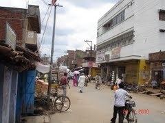 | ||
Neighborhoods Hamid Nagar, Churihar Mohalla, Sonar Toli, Bind Mohalla, Kumhar Toli, Barkat Nagar, Azad Nagar | ||
Helpline training centre pathalgaddha chatra jharkhand
Chatra is headquarters of Chatra district in the Indian state of Jharkhand.
Contents
- Helpline training centre pathalgaddha chatra jharkhand
- Map of Chatra Jharkhand 825401
- Geography
- History
- Demographics
- Literacy
- Transport
- References
Map of Chatra, Jharkhand 825401
Geography
Chatra is located at 24°12′16″N 84°52′37″E.
Chatra has several waterfalls around it: Gua Falls (6 km), Keridah Falls (8 km), Maludah Falls (8 km), and Bichkiliya (11 km). Balbal Duari (25 km) has a hot spring.
History
Raja Ram Mohan Roy, the prominent social reformer, worked as a Sirishtedar at Chatra in 1805-06 and lived both at Chatra and Ramgarh in this capacity.
Demographics
As per 2011 Census of India Chatra Nagar Parishad had a total population of 49.985, of which 26,555 were males and 23,430 females. Scheduled Castes numbered 3,454 and Scheduled Tribes numbered 242.
In 2001 census, Chatra had a population of 41,990, out of which 22,331 were males and 19,659 were females. 27,409 persons were literate.
Literacy
As per 2011 census the total number of literates in Chatra Nagar Parishad was 33,746, out of which 19,270 were males and 14,476 were females.
Transport
Chatra stands at the crossing of NH 99 and NH 100.